All posts by Haunted Rock

These are songs, poems and images from a life on the road. Enjoy your stay and safe travels.

pages fly away 12

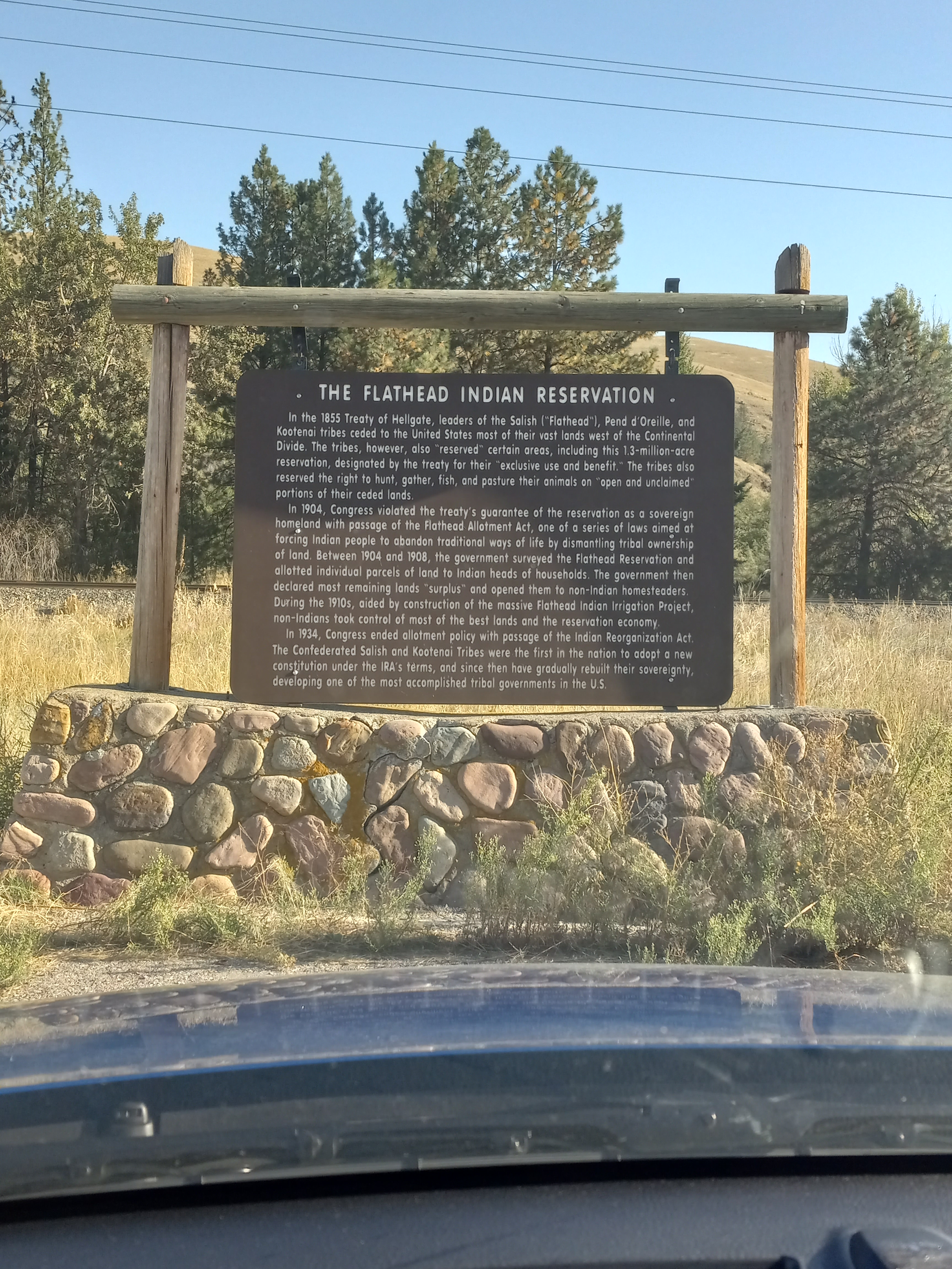
The Confederated Tribes of Warm Springs is made up of three tribes: the Wasco, the Tenino, and the Paiute.  They are some of the last to speak the Chinook Jargon, a pidgin trade language that originated in the Pacific Northwest.  Historically, their economy has been heavily dependent on fishing, but Iin 1964, a resort was completed, and in 2012, the Indian Head Casino was opened, with five hundred slot machines. 

I didn’t really know what I was doing there, just poking around more than anything.  I wasn’t about to drive around with a dream catcher dangling from my rearview mirror, trying to crash ceremonies.  If invited, I’d do anything.  If not, I’d try to remain unobtrusive.

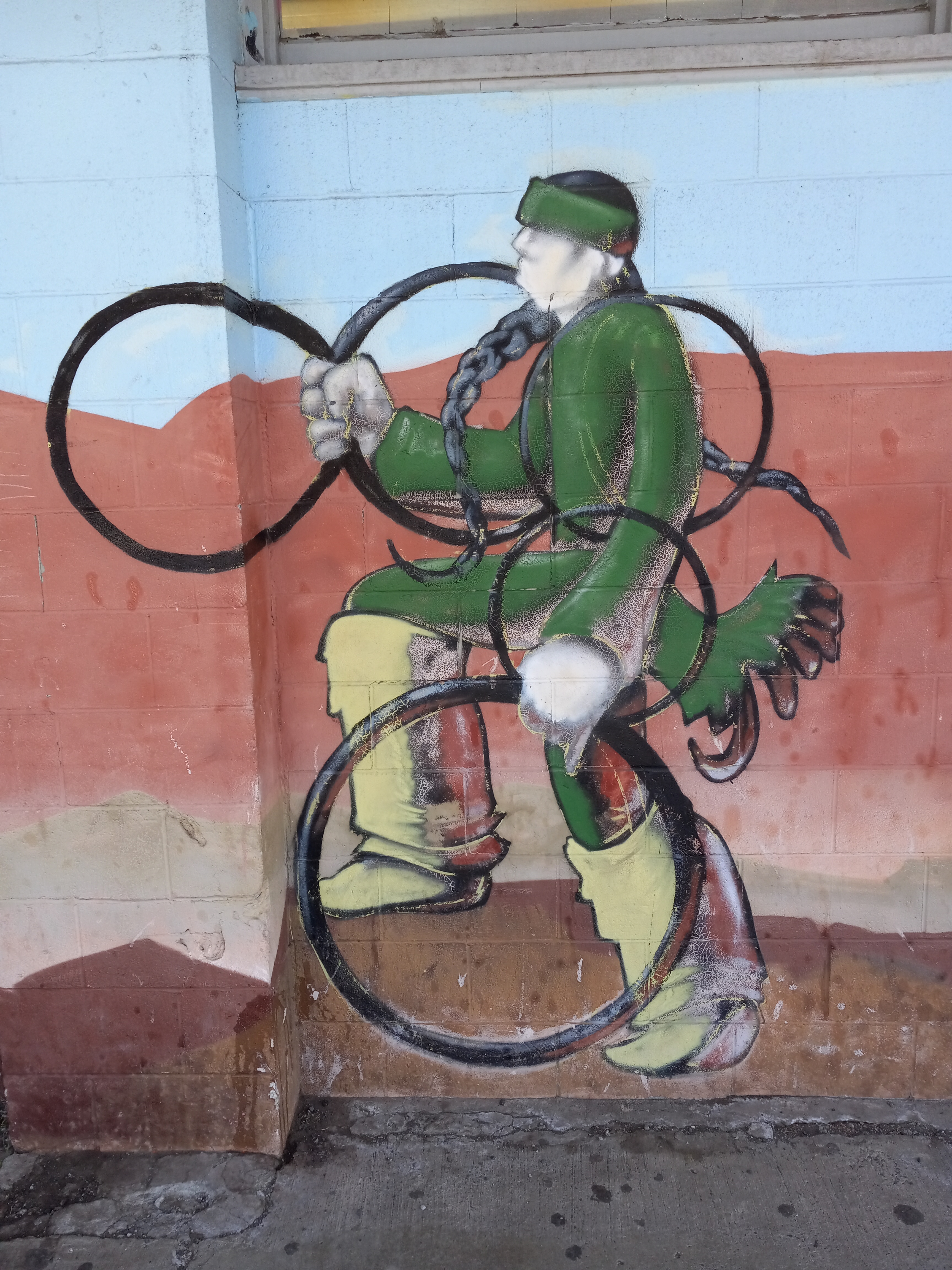
High upon a dry hill, beneath three tipis, was the name Warm Springs.  I drove into town, past the tribal headquarters and community center.  A restaurant in a trailer was selling Indian Fry Bread.  A sign advertised an upcoming suicide awareness walk.  There were some murals outside the Warm Springs Market, one of an elder, a woman, in a traditional basket hat and glasses.  There was another of a younger woman, wearing the same style hat and a jingle dress, clutching a flowered bag in front of her.  Then there was a hoop dancer, in a green shirt and headband, keeping five hoops aloft on his outstretched arms.

The hoop dance is popular with many tribes across the states, performed both in competitions and for healing.  The story is that a magical boy invented the dance, using the hoops to mimic animals and tell the stories of humankind.  Later, drums and flute were added, and the modern incarnation, created by Tony White Cloud in the 1930s, went on to incorporate multiple hoops, sometimes as many as twenty-eight at one time.

On another side of the market, there was a larger mural, that of a young man holding a frame drum, turning to face the distant snowcapped mountains.  All around him life was abounding, a salmon was leaping from a stream, two mule deer stood beside it, a bald eagle hovered overhead, a coyote snuck through the tall grass, two wild horses danced in the wind.  This is a vision of what life could be, not what it had become.

From the town of Warm Springs, I drove up to the northwest corner of the reservation and got on to highway 35, right at the base of Mount Hood.  Mount Hood is the highest peak in Oregon, with twelve glaciers and snow year-round.  A road crew was painting new yellow stripes down the center of the road, and I noticed it just in time and stayed far right.  Returning the Kia with yellow tires, along with all the mileage I was already racking up, would be hard to explain.

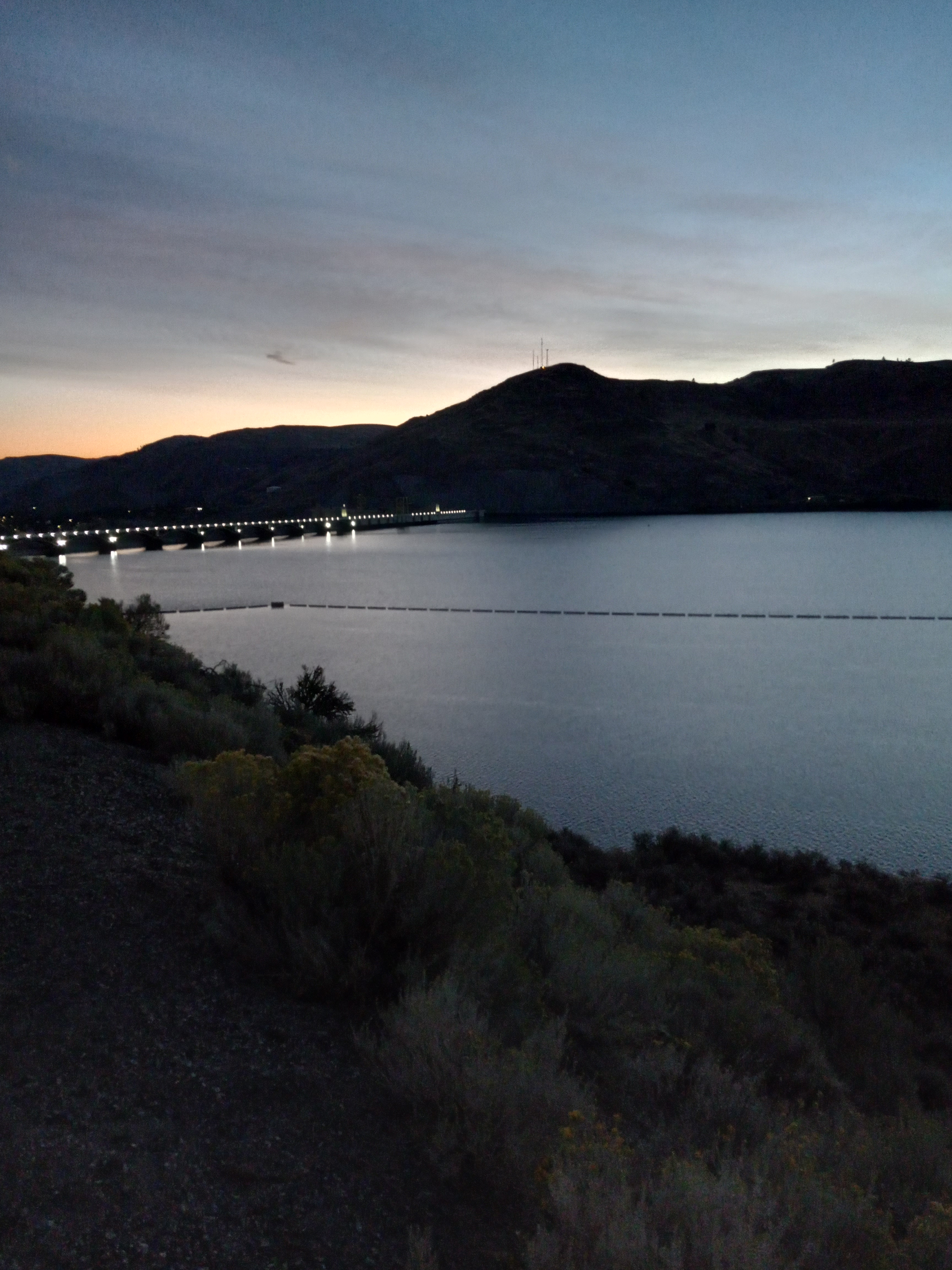
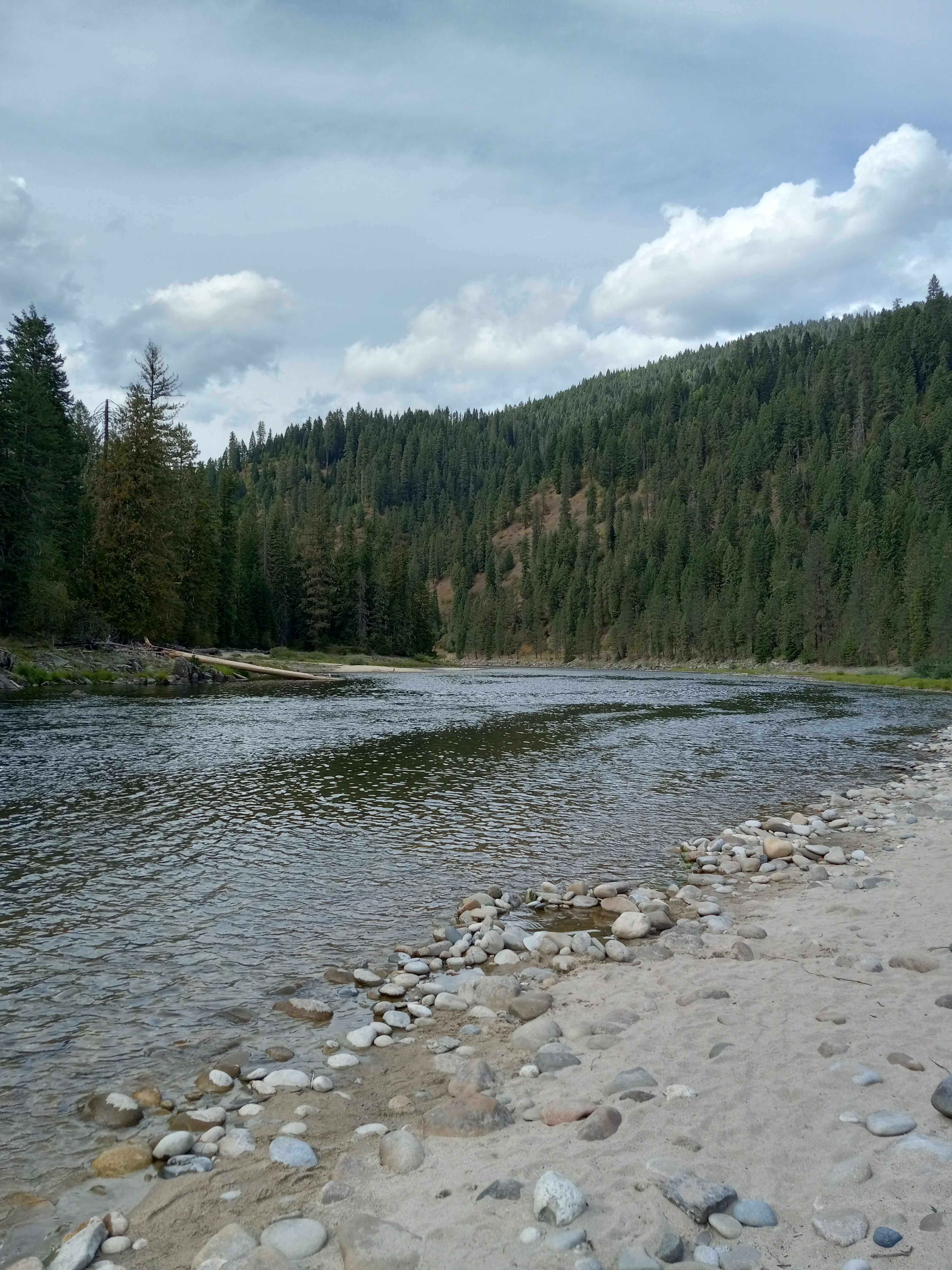
It wasn’t far from there to the Colombia River.  When I reached the town of Hood River, I got on the 84 west and went down to Cascade Locks, a system of canals and gates once used to navigate the dangerous rapids, and parked beside the Bridge of the Gods.  It was late afternoon by now and time to find a campsite.  Google Maps directed me back in the direction I’d just come, to a place called Wyeth Campground.  The owner was walking around with a clipboard when I pulled in and directed me to an open spot.  I set up my camp and then took a long walk to get my bearings and stretch my legs.

It had been a long day and I was exhausted, yet a tight wire of adrenaline was still buzzing in my brain.  I got in my tent early that night and waited for the sun to rise, tossing back and forth, and listening to the wind blow through the trees.  The only other sound was the pounding of my heart.

pages fly away 13

In the morning I followed the road over a bridge that crossed the highway.  On the other side, approaching the Colombia River, was a sign stating that the fishing rights belonged to members of the Nez Perce, Umatilla, Warm Springs, and Yakama tribes.  Further down the road was a fishing camp.  There was a red salmon painted on the side of a shack and a few men were working on a boat.  I cut straight over to the river and sat down on the bank.  It was another perfect day.  How many in a row had that been?

I found a fallen log with small, black stones scattered around it.  A clearing in the branches made a natural window.  I sat down and rested my hands on my knees.  The river splashed across the stones.  Cars went whirring past on the highway.  I could hear muffled voices from the fishing camp.  I closed my eyes and thought about the river.  I opened my eyes then shut them again, and it continued to dance across my eyelids.  Splashes of sunlight worked their way through my brain.

The Colombia River begins in the Canadian Rockies and runs 1,200 miles through seven states.  At one time it played host to the greatest salmon run on earth, but now, with nineteen hydroelectric dams on it, providing water and power to many, far less breeding salmon are able to return. The river still runs powerful and deep, however, and remains a force not to be trifled with.  The energy of it was apparent from where I sat.  Its great presence stirred something inside me, beyond the wild channels of imagination that were opening in my mind.  It moved my spirit.

When I opened my eyes, it felt like I’d been gone for a long time.  Walking back to camp, I came across some blackberry bushes.  They were loaded with ripe berries, almost enough to make a breakfast of.  I picked and ate them until my fingertips were stained purple.  A little further and I crossed some railroad tracks, gleaming in the sun. 

After breaking camp, I got on the 84 and headed east, only traveling thirty miles before pulling over to visit the Dalles.  The Dalles was once a major trading place for Native Americans.  Lewis and Clark passed through there in 1805, hoping to reach the Pacific Ocean. 

It was at the Lewis and Clark Festival Park that I pulled into, getting out and walking to a steamboat at the river’s edge.  It was named The American Pride. A few old women in period costumes, flapper dresses and glittering hats, were greeting passengers and passing out brochures.  A crew member confided in me that the cruise cost a thousand dollars a day.

A mural on the wall of the park called Sahaptin Medicine Man showed four pictures of the same shaman, in the first waving an eagle feather towards the river, in the second sitting cross-legged and playing a frame drum with his eyes closed, in the third tending to a small fire, and in the fourth, pulling salmon from rapids as they leapt upstream and drying them on a rack.  The medicine man lived away from the tribe and tended to matters of the body and spirit.  He was able to speak for the land and see renewal in all things.

The Dalles is the seat of Wasco County.  As I drove through the small downtown, I came across other murals commemorating the history of the region.  There were settlers on the Oregon Trail with their covered wagons and oxen, mountain men and trappers paddling canoes.  Another showed Natives, spearing fish out of the river, trading goods in baskets, and standing beside their horses.  A ghost sign, painted on a brick wall, advertised flapjacks.  Right next to it was a giant wagon wheel. 

A painting called Rock of Ages showed a preacher standing high on a rock, preaching to a congregation of Native Americans.  There is a lot they would come to know about the White Man’s Book of Heaven.  This new medicine came with side effects that were worse than any disease.  The medicine man had no power to cure them.  The time of troubles was just getting started.

pages fly away 14

From the Dalles, I took the 84 east to the 97, and traveled north towards the Yakama Reservation.  The Confederated Tribes and Bands of the Yakama People is made up of seven tribes and occupies two-thousand square miles in Southern Washington, bordering the Cascade Mountains. 

The first city I came to after entering the reservation was Toppenish, known as the City of Murals.  The meaning behind that name was soon evident, but first I stopped at the visitor center.  The attendant there was friendly enough, retired from the highway patrol, and invited me to use the bathroom without my even asking.  I learned that the first mural was completed in 1989, intended to correspond to the state centennial, and that since that time seventy-eight more murals had been added.  If a town wants to draw attention, I can’t think of a better way to do it. 

Toppenish was full of history and art, a crash course in all things related to the Wild West.  One side of a building showed a group of long-horned cattle being driven down an unpaved main street by a few cowboys, past a Drugs and Sundries shop, and a young man reigning in two horses attached to a wagon.  Another depicted a cowboy in a rodeo, busting through the wall on his horse, waving a lasso over his head, on the heels of a frantic steer. 

According to the Treaty of 1855, fourteen tribes ceded eleven million acres to the United States.  In a mural depicting the meeting of the governor of Indian Affairs, Isaac I. Stevens, and the Yakama chief, Kamaiakun, an American flag stands next to an Indian spear, with calvary troops riding in one direction, and Native warriors riding in the other.  It appears as if an equitable agreement had been reached and both parties are departing in peace.

Not far from there was a marker indicating where Captain A.J. Hembree was killed by Indians in 1856.  Hembree was a volunteer from Oregon, who was shot in the gut during a skirmish with the Yakama.  Apparently, the other volunteers fled and Hembree was able to hold off his attackers a while longer, but finally he was killed and scalped.  His body was taken back to Oregon to be buried.

Walking further, I stopped outside the Post Office and read about the early days of mail delivery.  Apparently, in those days the postman had to supply his own horse and buggy and the route was twenty-three miles long.  He had to travel over rough roads and ford streams to get the mail delivered, and that’s when the weather was good.  In the wintertime, he was lucky not to freeze to death.

A few blocks later, I stopped outside the Yakama Nation Victim Resource Program.  The painted windows showed a powerful Thunderbird, a loving couple, and a happy balanced family, standing outside a tipi.  It seemed to be their mission statement.  Then I went over to read about Alex McCoy, from the Wishram and Wasco tribes, who became a cowboy and went on to invent bulldogging, a rodeo sport in which a steer is wrestled to the ground.  In the years that followed, he became a shaman and judge, and lived to be a hundred and four.

One mural with a caption told of Irish Dick, a sheepherder who once traded a bear cub for whiskey.  Upon his return to town, the now fully grown bear escaped from its chains and a tussle between the two of them ensued on Main Street.  Eventually, the bear was returned to the saloon and Irish Dick was taken to the hospital. 

There was a shop window with black and white photos of tribespeople in their ceremonial clothes, a group of women and girls in beaded dresses and headbands, a chief in full feathered headdress, a necklace of bear claws draped around his neck, holding a rifle at his side, other leaders in headdresses led a procession of horses down the street.  It was like I’d been transported back in time.

On my way out of town, I stopped at a 7-Eleven.  There were even murals outside of that, dancers demonstrating the Prairie Chicken Dance and the Owl Dance.  I got a hotdog and soft drink and pulled over at Pioneer Park to eat.  There I saw a news crew setting up.  They interviewed a man who came stumbling towards them with a bandana covering most of his face and a COVID mask covering the rest.  He was also wearing sunglasses, so it was almost like they were interviewing the Invisible Man. 

Maybe that’s how it felt to be landlocked in such a rich country, stripped of his way of life, and sleeping in the park.  And what about that COVID?  What would they think of next?

pages fly away 15

It was only three hours to my next destination, the Colville Reservation, but already late afternoon by the time I left Toppenish.  I opted to take the 97, a small country road that wandered through the mountains, and paid for it by getting stuck behind an RV that was pulling a whole train of us behind it, all of us maxed out at forty-five miles an hour, unable to pass because of the curves and hills. 

Then I took the got on the 2, driving through Entiat and Chelan, and stopped for gas in Brewster.  I wanted to drive across the reservation, so went as far north as Omak where I picked up the 155 heading east.

The Colville Reservation is nearly three million acres, and twelve tribes make up the confederated tribes that live on the land.  Like many of the Natives of the region, they lived a semi-nomadic existence before the arrival of the Europeans and Americans, migrating according to the seasons and cycles of nature.  They got fish from the rivers.  They gathered berries and hunted deer on the plateau.  They went where they needed to and did what they had to do to survive.

Of the twelve tribes, the one group of outsiders was always the Nez Pearce who followed Chief Joseph.  Originally from Wallowa Valley in Oregon, they were forced onto a reservation in Idaho that they fled from in 1877.  Their hope was to join Sitting Bull in Canada, and they nearly made it, traveling 1,170 miles, all the while fighting off the U.S. Army, which was in hot pursuit. 

Finally, only forty miles from the border, his people starving and freezing, Chief Joseph was forced to surrender.  He did so on the condition that they be allowed to return to Idaho.  Instead, they were shuffled from reservation to reservation, and finally ended up at the Coleville Reservation, having little in common with the tribes already there. 

Nowadays, Chief Joseph is seen as a hero of the Indian Wars, admired for the resistance and ingenuity he and his followers displayed in the face of overwhelming force, as well as for his humanity and eloquence.  He spoke honestly in defeat about not only his sorrow and loss, but also the need for there to be equality among all men.

Driving south on the 155, I passed Nespelem, where Chief Joseph is buried, and a rest area serves as a monument.  There is a metal sculpture of him, balancing a peace pipe in his hand, as well as other sculptures, a warbonnet, a warrior on horseback, a woman behind, also on horseback, dragging a travois with a child perched on top.  A plaque outside the bathrooms tells the story of Chief Joseph and his tribe.

My goal that day was to make it to the Grand Coulee Dam, and it was already nearing sunset by the time I did.  As had become customary, I was leaving everything to chance, hoping another campsite would roll into view once I needed it.  By now, there were three of us on the journey, myself, the rental car I’d dubbed the Mountain Bluebird, and the woman from Google Maps.  I’d checked to see if she had a name, and discovered it was Karen.  Karen it was then. 

Google Maps located a campsite on the other side of the dam called the Spring Canyon Campground.  I never would’ve found it on my own.  There were no signs, nothing in my book of maps to indicate a campground anywhere in the vicinity.  I pressed start and Karen began to guide me there.  I followed River Drive and crossed the Grand Coulee Bridge.  From there I took a left on the 155 and passed the visitor center, making another left on Grand Coulee Avenue, past hotels, an RV park, and churches.  There was a long driveway to the campground that passed a cemetery.  By the time I arrived, it was rapidly growing dark.

There were plenty of open spaces.  That came as a relief.  When I went to pay, however, I discovered that reservations were required, and they didn’t accept cash.  Good God.  What a hassle.  I had two choices, either to pack it up and move on, or to stick it out and try to explain the situation if a ranger showed up. 

I went with the latter but couldn’t rest easy that night.  There were deer and quail right outside the door, but a fear had been planted in my mind.  I was going to get busted, maybe get a fine or get kicked out in the middle of the night.  Every time I heard a noise, I stiffened.  Then the wind picked up and I was the only thing weighing my tent down.  Finally, I just crashed out of exhaustion.  The plan was to sneak out before the first light of dawn.

pages fly away 16

The Grand Coulee Dam, completed between 1933 and 1942, stands at 550 feet and is one of the largest power stations in the United States.  It also provides irrigation for nearly 700,000 acres. 

If I knew anything about the dam before visiting, it was that Woodie Guthrie had once been commissioned by the Department of the Interior to write songs about the Colombia River and the construction of the dams.  He wrote twenty-six songs, but then the film that they were to be a part of got postponed because of World War II and didn’t come out until 1949.  The songs eventually made it on an album called Colombia River Ballads.

It was still dark when I broke down camp at the Spring Canyon Campground and loaded up the car.  By now I had it down to an art.  It was guerilla camping at its finest, in and out with hardly a trace.

Before hitting the road, I wanted to go sit and meditate beside the dam.  I pulled up at an overlook beside the visitor center and sat down on a rock.  The faintest light of day was just showing behind the eastern hills.  It was cold, and though the wind had died down some, it was still gusty.  I went back and sat in the car, looking down at the lights of the dam, the ropes and buoys stretched across the surface of the water.  The window was down, and I could hear the cry of waterbirds below.

There was no one else out.  The awakening day was mine alone.  The light gradually grew brighter.  Ripples spread across the water.  In that grand setting, I sat and obsessed about the idiocy of requiring reservations for camping.  All night I’d lay there paranoid, the tent being battered by the wind, thinking I could hear the engine of a vehicle idling, imagining I could hear footsteps approaching my camp. 

What if there was a hidden camera set up somewhere?  Could they have gotten my license plate number?  Would they send a bill, and possibly a fine, to the rental agency?  Now I started worrying about the rental agency.   What did they really mean by unlimited mileage?  Was I even allowed to take the car out of state?  I was sure that they were tracking me.  In this day and age, how could they not be?

I sat there and worried until the sun came up.  Did sitting in a car worrying count as meditation?  If so, then perhaps I belonged to the most spiritually evolved nation that has ever existed.  All those millions of people sitting in their cars and worrying.  But were they counting their breaths?  Maybe, yes.  Maybe, no.  I was sitting in a car and worrying, but I was also counting my breaths.  That had to stand for something.

At one point I opened my eyes and simply drove off.  If I couldn’t conquer my energy, I could at least harness it.  There were days and miles ahead of me.  I simply had to get going.

The sky that had begun to brighten returned to slate.  I got on the 174 and then headed east on the 2 at Wilbur.  The land was barren and flat.  The highway stretched on endlessly.  I wasn’t sure where I was going.  From the looks of it, that would be Idaho.  I passed small farm towns with silos and grain elevators.  One bar with a painted cowboy outside promised live music and dancing.  I passed the Spokane Tribe Casino, and figured I’d stop in Spokane.  Instead, I just kept driving, seeing that Coeur d’ Alene was only thirty miles away.

Two reservations that I could get to that day were the Cour d’ Alene one and the Nez Perce one, both in Idaho.  I thought I might drive down to the Snake River and Boise after that.  I really had no idea. 

From the city of Cour d’ Alene I got on the 95 south, briefly pulling over at the Cour d’ Alene casino.  As someone without the means or inclination to gamble, I’ve never been interested in casinos.  So far, every reservation I’d passed through had one, so they must be doing some good, or at least somebody is prospering.  A statue of a warrior on horseback, in full headdress, raising a stick to the sky, sat atop a small waterfall, and welcomed visitors to this one.  Driving through the parking lot, I passed cutouts of a buffalo and a moose.

The sky had turned blue by now and white, puffy clouds drifted across it like grazing sheep.  I continued on my merry, frazzled way, until pulling over for gas in Plummer at the Warpath One Stop.  Everything here had a native theme.  Two buffalos stood at the door.  The ad for Seneca Cigarettes featured an Indian head.  There was a trading post selling regalia and supplies.  By the side of the store there was an old totem pole.

Cour d’ Alene, translated from French means heart of the awl.  An awl is a sharp tool used to punch holes through leather.  The name was bestowed upon the people by a French trapper who considered them the sharpest traders he’d ever met.  The reservation was established in 1873. 

Driving on through town, I passed the Tribal Police and then stopped at Benewah Plaza to pick up some groceries for the road.  Atop the sign for the plaza was a cutout of two dancers.  Granted, I’m no expert, but it looked to me like at least one of them was doing the Prairie Chicken Dance.

pages fly away 17

While it had been cold and overcast outside of Spokane, while traveling down the 95 through Idaho, it actually started getting hot, up to eighty degrees.  I thought I’d probably drive to Boise, but then saw that it was over three hundred miles to get there.  The other option was to get on the 12 once I reached the Nez Perce Reservation and head towards Missoula and the Flathead Reservation in Montana.  Up until the very last second, I didn’t know what I’d do, but once I reached the Lewistown Lookout, with a view of the first capital of Idaho, along with all the hills and Clearwater River below, I instinctively followed the river east and got on the 12.

Nez Perce means pierced nose, a name bestowed on them by the French, perhaps erroneously, as it better described the Chinook tribe.  The Nez Perce call themselves the Nimiipuu, or the People.  Although their ancestral territory is in Oregon, a treaty in 1863, that came to be known as the Steal Treaty, saw them relocated to reservations in Idaho, Washington, and Oklahoma.  The privatization of the reservations yielded subsequent losses, so that today a majority of the occupants of the reservation in Idaho are non-Natives.

As I drove along the Clearwater River, I pulled over at an archaeological site, that of a Nez Perce Village where pit houses were discovered that date back at least five thousand years.  A few miles from there I came across a signpost telling the legend of Coyote’s Fishnet.  Exasperated by nosy Black Bear, Coyote threw his fishing net upon one mountain, then turned Black Bear to stone, and cast him upon another.  They became landmarks that natives can easily identify.  Coyote also used the same magic powers to turn a quarreling ant and yellowjacket into a stone arch.  I read about that legend a few miles down the road.

It had been a week of manic driving and I was starting to crack a bit.  I’d started the day off by worrying, and was falling into a depression, beginning to fret about everything, even though the road I was on at the moment, running parallel to the river, with a sky up above, stacked with white clouds, was like something out of a vision.  I knew I was tired and kept reminding myself that was why.  It would be a good day to find a campground earlier than later and try to catch up on some sleep.

After driving about an hour, I came across a town called Kooskia.  A mural on the side of a bar proclaimed into to be the Gateway to the Wilderness and pictured Bigfoot stepping around the corner.  I was so tired at that point I thought of looking for a hotel, but instead filled up with gas, got a microwave cheeseburger, and kept driving.

Just a few miles down the road, there was a bridge that crossed the river and an arrow pointing to a campground.  I crossed the bridge and ended up driving a long way down a dirt road to reach it.  It was a good thing that I did, as it was nearly perfect, with many open spots beside the bank.  No reservations required.  It was the good old-fashioned camping that I was used to, grabbing an envelope from the registration site, filling it out, stuffing the money inside, not much money either, maybe ten or fifteen bucks, then sticking the tab on the post to let people know the spot was taken.

It was perfect camping weather.  Not too hot and not too cold yet.  The only problem was the flies.  I went to sit on the picnic table and play ukelele and they attacked me.  If I would’ve tried meditating, they would’ve carried me off.  It was too early to zip myself up in the tent.  I sought cover in the river, changing into shorts and hobbling over the stones to get to it.  It was ice cold, but incredible.  I hadn’t bathed in a week.  The stink that came off me stopped the flies in their tracks.  The water was shallow where I was at.  I lay on my belly and pushed myself towards the small rapids with my hands.  Then I was off zooming forward, plunging headfirst into a waist-high pool. 

A little of that went a long way.  I got out freezing, with a big ice cream headache, and walked like a mime stepping on glass.  It took about ten minutes to get back to the car.  After changing back into my clothes, I went back to my ukelele trance.  Either the flies had learned their lesson, or I was just too blissed-out to care.

pages fly away 18

There were about six hours where I slept soundly, from about nine until three.  My mind was clear and sharp when I awoke.  I sat up in a cross-legged position and pulled my blankets over my shoulders.  The meditation I’d been practicing so far had been an honest attempt, mostly just sitting there thinking, trying to corral my thoughts and focus on my breathing.  The day before I’d just sat there worrying.  Now I closed my eyes and listened.  There was the sound of the river and the quiet chirping of a few crickets.  It was a moment that wasn’t hard to stay in.  I could almost see the river, shining in my mind.

When I finished my breathing cycle and said the last of my prayers, I stumbled out of the tent and could hardly believe what I saw.  The stars in the sky were so close it was like looking at a city of lights.  There was Orion.  Betelgeuse.  Bellatrix.  Rigel.  Beyond it, the Pleiades, magnified and throbbing.  The light of a satellite crossed the sky.  It seemed to be the size of a dime.  I was awake in body and awake in mind.  The connection between all living things had never seemed so clear, all pulsating cells in one great body.

In the darkness of early morning, I loaded up the car and got on the road.  It was three hours to Missoula.  By the time I arrived there it was still early.  My destination was the Flathead Indian Reservation.  It wasn’t far.  I took the 90 east to the 94 and then ran into some extensive roadwork that slowed things down considerably. 

The Flathead Indian Reservation is home to the Confederated Salish and Kootenai Tribes of the Flathead Nation.  Although cranial deformation was practiced by some of the tribes at the time, the Flatheads were given their name because they didn’t compress their skulls into the peaks that some of their neighbors did.  Still, it is a curious name to bear, bound to conjure up some strange conceptions.

The reservation was established in 1855 when the Treaty of Hellgate was signed.  It occupies two thousand square miles, with only nine thousand of the population of nearly 30,000 identifying as Native American.  Like what had happened with the Nez Perce, this came about when the government began allotting lands to individuals instead of keeping the holdings communal.  Like the other reservations I’d driven through, there weren’t many obvious signs I was even on one, just ordinary houses and businesses, the land looking roughly the same as it did outside the borders.

On the Flathead Reservation what I was interested in seeing the most was the National Bison Range.  The American Bison, or Buffalo, once ranged from Alaska to Mexico, Nevada to the Appalachians, with numbers in the countless millions.  By 1889 they were almost extinct, down to five hundred animals, hunted by traders and settlers, often just shot for sport, and also systemically slaughtered by the U.S. Army as a strategy to strip the Native Americans of their greatest resource.  The tribes depended on the buffalo for physical and spiritual sustenance, and were lost without them, left starving and demoralized, without the vital magic needed to infuse their ceremonies or lift their morale.

To reach the Bison Range, I took highway 200 west and then got on the 212.  I could see a few bison on the side of a hill leading up to the entrance.  When I pulled into it, a man with a limp was walking towards a van.  He got in, just as I was passing, and followed me up to the parking lot, where a tribal flag was flying beneath an American one.  I went in and looked around.  There was a stuffed buffalo on a small, artificial terrain.  On a wall were the mounted heads of an elk and a deer.  Another wall had a medicine wheel that had been quartered into the four seasons. 

It was ten dollars to visit the range, which I was happy to pay.  The attendant then explained that the tour was a three-hour drive and could only be driven in one direction.  I asked what other animals I might see.  She said there were deer, pronghorn, and an area with blackberry bushes where some bears had been spotted.  Three hours sounded awful long.  My next stop was Yellowstone, and I was spending most of my time in the car as it was.

I went out and got in the car.  As I drove towards the wildlife loop, the man in the van suddenly started it up and began driving right on my tail.  It felt like I was being followed.  I drove until the road became one way and suddenly pulled off.  It was too late for him to make an adjustment.  I saw him looking back over his shoulder, unable to turn, suddenly committed to a three-hour tour.  That made me laugh.  What was up with that guy?