All posts by Haunted Rock

These are songs, poems and images from a life on the road. Enjoy your stay and safe travels.

pages fly away 19

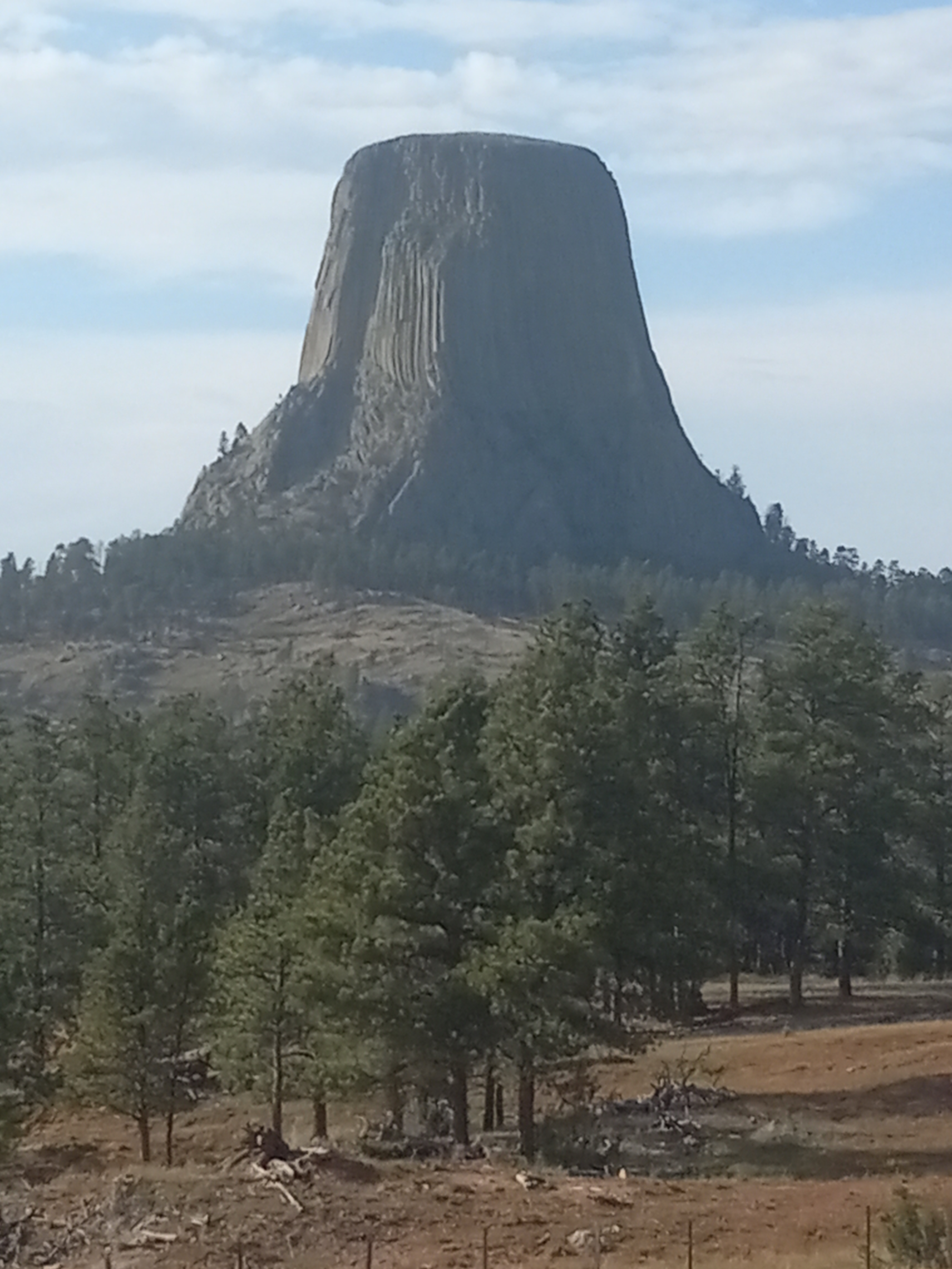
It was over three hundred miles to Yellowstone.  The plan now, which only materialized after reaching the previous destination, was to try to make it there by early afternoon.  I’d left before sunrise to be at the Flathead Reservation, and now sped south, from Kicking Horse back to the 90-freeway heading east.  I’d been on all kinds of roads the past week, but few freeways.  Speed didn’t feel much of a factor on the freeway.  At one point I looked down and saw I was going ninety miles an hour, and other cars were still passing me.  It was like I was racing for my life.  If I couldn’t see all of America in six weeks, then I was screwed.

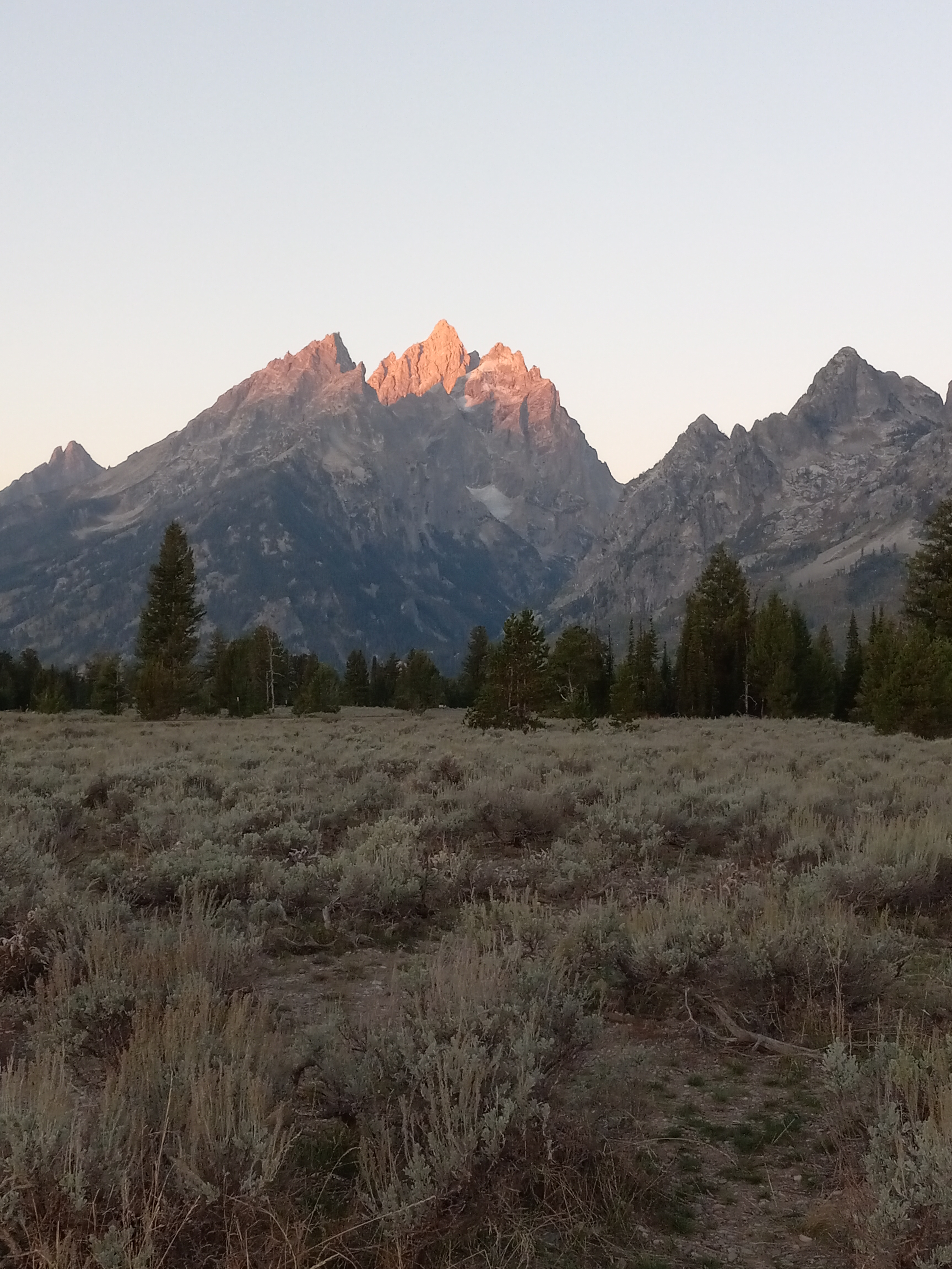
Montana is the Big Sky State people dream about.  Beyond the windshield that was all I saw, an enormous blue sky and white clouds, with an occasional snow-capped mountain leaning into the picture.  I sped past Bearmouth and Deer Lodge, then took the 359 at Cardwell to the 287 south at Harrison.  That road was a wilderness rollercoaster.  I barely slowed down from the freeway, riding each hump high, leaning into every curve.  By the time I got to Hebgen, or Earthquake, Lake, the muscles in my back were strained.  I had to get out of the car to take a look.

The lake was created in created in 1959 when an earthquake killed 28 people and caused millions of dollars in damage.  According to some survivors, it was the loudest noise they’d ever heard.  If the victims weren’t killed by the earthquake, which opened up a chasm in the earth, then they were done in by the landslide, and if that didn’t get them, they probably drowned in the resulting flood.  Houses, roads, bridges, and even large sections of forest were all destroyed.

I knew I was playing with fire, showing up at Yellowstone without a reservation.  That summer season some of the National Parks had started requiring reservations to get in.  I knew that getting a campground was out of the question, but not to even get in would’ve been a stunning blow.  As it was, my luck held out.  Fortune continued to ride on my shoulders, at least until that evening.

At the West Gate I presented my National Park Pass and it was met with a smile and free map.  I’d been to the park three or four times by now and was only interested in the southern passage, the one with the greatest concentration of geothermal activity, leading to Old Faithful.  Once I got into the park, I saw that the highway was jammed coming from the opposite direction and jammed up on the 89 heading north.  Going with the flow had served me well, so far.

Yellowstone is mostly located in Wyoming, but also extends into Montana and Idaho.  It was created in 1872, the first National Park in America.  It provides haven for 70,000 species of plants and trees, and animals which include wolves, coyotes, cougars, lynx, black bears, grizzly bears, bison, moose, mule deer, elk, pronghorn, mountain goats, and big horn sheep.  It is the Serengeti Plain of the Americas.  All of the geothermal activity in the park is due to the fact that it rests on a volcanic caldera that runs 37 by 18 miles, and 3 to 7 miles deep.  This gives rise to the many geysers, hot springs, mud pots, and fumaroles, or steam vents, that make it such a singular destination, as if it weren’t already special enough.

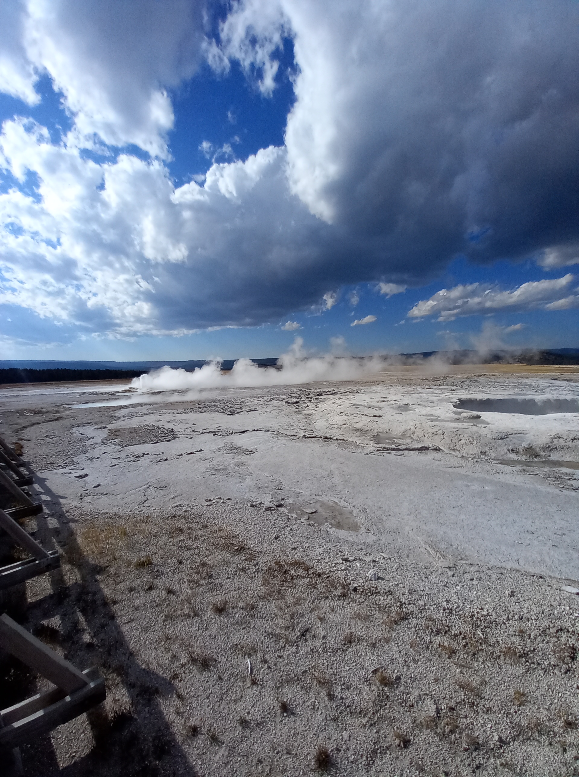
There were a lot of visitors when I pulled over at the Fountain Paint Pot Trail, but it could’ve been way worse.  There were still places to park and a little room to roam.  A sign at the entrance warns of boiling water and unstable ground.  It was like taking a Spirit Walk, no drugs or initiation necessary.  The landscape was that revelatory, a place where the sky and underworld meet, a collision of elements and minerals, danger, and shape-shifting vapors. 

I walked through a stretch of stripped trees, trapped in a chemical bath.  Ravines and fissures ruptured the earth, like a view of the desert from an airplane.  Beyond that, clouds of steam drifted beneath the great fortresses of white cloud rolling through the sky.

I reached the Celestine Pool, so very blue it sought to rival the sky.  To dive into it would mean being scalded alive, but what a way to go.  Across the way, a white mud pot gargled and belched.  Above it, the clouds had now turned blue.  My shadow, and that of the fence, fell across the walkway, the essence of a transitory moment.  I would go first.  The fence would go second.  The mud pots would outlast us all, but even they would meet a change.  What would last?  The earth?  The universe?  Not even those, not forever.

Down the road, was the Midway Geyser Basin.  Here I had to park beside the road and walk a long way back.  Crossing a bridge, I followed the walkway past the Excelsior Geyser Crater, on my way to investigate the largest hot spring in the park, the Grand Prismatic Spring.  The water on each side was shallow, acidic, and treacherous.  A dozen hats floated on it, blown off and never to be fetched.  In some areas the water reflected the sky like a mirror.  There were clouds above and clouds below.  Steam floated in between.  Other visitors, staggered along the boardwalk, took on ghostly attributes.  It was eternity, in the blink of an eye.

I’d already seen more than enough to justify my visit but couldn’t help stopping by the Old Faithful Inn to see if I could watch Old Faithful blow.  Since it erupts twenty times a day it seemed my chances were good.  Old Faithful is the biggest celebrity in the park.  If not the largest or oldest of the geysers, it is certainly the most famous, and that has something to do with its consistency.  At the Inn, they were predicting that it would blow within the next hour.  Although it was getting late, I could wait around for that.

In the cafeteria, I got a pulled pork sandwich and tonic water and returned to Old Faithful to get a seat up front.  A few hundred visitors were waiting.  A few times the geyser got a little active and faked everyone out, but then simmered down again and bubbled underground.  It wasn’t until I’d taken the last bite of my sandwich and put my garbage in a trash can that it went off.  Hurray, just like the 4th of July.  It shot a hundred feet in the air.  Everyone got to their feet.  A few people began to applaud.

As soon as it started going down again there was a mad rush for the parking lot.  It was like leaving a baseball game after a walk off homerun in the bottom of the 9th, a big celebration, but also a hassle to get out.  The sun was sinking quickly.  I needed to find a camping spot.  So far, I was eight for eight on finding some place to camp at the last second.  My luck was about to run out.

pages fly away 20

From the parking lot of the Old Faithful Inn to the Grand Teton National Park is a distance of about ninety miles.  To think that I could reach it was a stretch, but I knew I wouldn’t be able to camp at Yellowstone, seeing that I hadn’t made a reservation.  Old Faithful had just blown, and the traffic was horrible.  In a few minutes my mood went from elation to fury.

There were around twenty cars stopped in both lanes around the south exit, entirely blocking the road.  I hit the dashboard with both hands and craned my neck to see what the hold-up was.  It was a herd of elk crossing the road, taking their time, not shy at all about the tourists jumping out of their cars to take pictures.  Oh my God.  The sun had now set.  In less than an hour it would be totally dark.

I had had extremely good luck so far, using Google Maps to find campgrounds at the very last minute.  There were bound to be dozens of campgrounds outside the park, I reasoned, Yellowstone being one of the most popular campgrounds in the world.  I turned to my phone and found that I had lost service.  Curses.  There was no signal at all.  I couldn’t call anyone or use the internet.

The sky was still pink.  There was nothing to see besides the trees growing on both sides of the road.  No one else was in a hurry.  There was no way I was making it to the Grand Tetons, no matter how many cars I passed or how much I swore.  I was just going to have to just hunker down somewhere and wait it out.

All the campgrounds I passed were full.  My last chance was at Colter Bay Village, right beside Jackson Lake.  It was dark when I pulled up to the campground there.  It too, was all sold-out.  I drove down and sat in a parking lot beside the lake, wondering if I could just tilt my seat back and sleep there.  It was way too out in the open.  Someone was sure to come along and hassle me. 

Next, I went and parked in the parking lot of a lodge, crammed between two larger vehicles.  Someone was making the rounds on a golf cart, possibly checking license plates.  I got paranoid and bolted from there, not knowing where I was heading.

It was so dark by now I needed my headlights on bright.  For the first time on my trip. I was screwed and knew it.  I’d had to just pull over anywhere I could and wait for daylight.  One lot I happened across had signposts with information about the Tetons, and also a closed-down camper, that served as bear country headquarters.  No one else was parked in it.  I figured I’d take my chances.

It was one of the longest nights of my life.  Sitting in the car, driving around the country was one thing.  Sitting there trying to sleep, was another.  At one point, I tried to lock the car doors from the inside and the car alarm went off.  Nothing I did made it stop.  I was desperate, inconsolable, screaming at the top of the lungs.  Finally, I opened the car door, and it got quiet.  Then the car wouldn’t start.  The whole system seemed to be disabled.  Never had things gone from so good to so bad in such a short time.  I tried to calm myself down.  There had to be an explanation.  If there was, I never found it.  Just by fluke, I stepped out, locked and unlocked the doors a few times, and when I got back in, everything was back to normal.  That had been way too close for comfort.

That night it got freezing cold.  I put a blanket over my head and was buffeted by my own bad breath.  When I got out to take a piss, the stars were brilliantly shining overhead, on this night like cruel, sharp diamonds.  A few shooting stars streaked across the sky. 

At three o’clock in the morning, I started the car and turned on the heat.  A few hours later, I started to drive towards the Grand Tetons, figuring I’d try to be there by sunrise.  I got on the 191 and headed south, only the faintest ripples of light now appearing on the Snake River, which ran beside the road.  There were still a few stars left in the sky.  Most of them had dimmed considerably.

The Grand Tetons are the youngest mountain range in the Rocky Mountains.  They were formed between six and nine million years ago, when two faults collided and one shot skyward, giving them their jagged, rough-hewn edge.  They were of great importance to the Shoshone tribe, who hunted big-horn sheep there, and there are stones enclosures on the upper slopes that they journeyed to on vision quests.

Although, my thought was to meditate at the base of them, the journey I was most likely to take would be one into fitful sleep, having slept only one or two hours the previous night, at most.  I pulled over at the Snake River Overlook, with as good a view of the three peaks as I was going to get and turned off the engine. 

What I did then, was largely dream sitting up.  No white wolf came down from the mountain.  The voices of my ancestors didn’t ring in my ears.  No.  I just sat there in exhausted confusion and thought about getting a hotel that night.  I was running myself ragged and for what?  On this morning, I really wasn’t sure.

pages fly away 21

The Wind River Reservation in central Wyoming is shared by two tribes, the Eastern Shoshone, and the Northern Arapahoe.  At around two million square acres it is the seventh largest reservation in the US by size, and the fifth largest by population.  It was established at the Bridger Treaty Council in 1868.

The goal that day was to drive through the Wind River Reservation and visit the grave of Sacagewa, the Shoshone Indian woman who had joined the Lewis and Clark expedition with her husband and played an important role in their success.  My phone service was still out, so I’d have to go old-school with the Atlas.  The directions seemed simple enough.  It was just a two-hour drive to get there.

Along the way, I pulled over at the National Bighorn Center, only stopping out front to take a picture of a statue of a bighorn sheep with a blue bandana around its neck.  There was so much I was seeing, and still wanted to see, that there was barely time and space in my mind to process it all.  My brain was crackling with fatigue, but still surging forward, already anticipating how much further I could make it that day.

When I got to Fort Washakie, there was an arrow that pointed towards the grave of Sacagewa.  When I followed it, however, I only got as far as the grave of Chief Washakie.  Chief Washakie, who lived between 1810 and 1900 was one of the greatest Indian leaders, not only in Shoshone, but in American history.  He was inducted into the Western Heritage Museum in 1979, and even has a statue in the National Statuary Section of the Capitol in Washington, DC.

He was first named Smells of Sugar, but later changed that to Shoots the Buffalo Running, and was also known as Gourd Rattle, due to his success as a gambler, rolling stones from a gourd.  He proved to be a great warrior during intertribal warfare, and later helped lead the army of General George Crook to victory over the Sioux.  Doing so, he became the first Native American chief to have a military outpost named after him and be buried with full military honors.  One of the legends attributed to him is that of defeating his Crow enemy, Chief Big Robber, and returning with his heart skewered on his spear.

I looked for some sign of Sacagewa in the cemetery where Washakie is interred but could find no mention of her.  Without Google Maps, I was lost.  I had to go back into town and ask a woman at the gas station how to get there.  I’d been on the right road.  I just needed to travel further.

Sacagawea has become a heroine of Western lore, due to her involvement in the Lewis and Clark expedition, where she and her husband acted as guides and interpreters.  At one point, they met a band of Shoshones, and the chief was her brother.  She was able to use that influence to trade for horses.  Sacagewa was pregnant and gave birth during the journey, and from what I understand, just having a woman and child traveling with the party signified that their intentions were peaceful. 

There are two stories on what became of Sacagewa.  The first is that she died in her mid-twenties giving birth.  The second is that she returned to her homeland and married a Commanche, eventually living to be one hundred.

The cemetery was worth searching for and finding.  Colorful wooden crosses, marking the graves of other tribe members surrounded hers.  Flowers adorned many of them.  The statue of Sacagewa made her look like a Native Madonna, barefoot, with a flowing dress to her knees.  Someone had placed a string of shells around her neck and ankle.  The pedestal she stood on had three roses painted on the front of it, and stones and pinecones had been scattered around her feet.

pages fly away 22

Ten days into my big road trip and I was still flying like a bird, not knowing where I’d land next.  The blue Kia I’d rented, the Mountain Bluebird, was running like a champ, and had almost become a part of me, like the lower half of a Centaur.  Although I’d temporarily lost contact with Karen from Google Maps, I wouldn’t be thriving without her assistance either.  T-Mobile needs better allies in Wyoming, however.  I can tell you that. 

Right now, I could make it with just a road map, but come evening I’d need more help than I was getting if I didn’t want to spend another night sleeping in the car.  Maybe it was finally time to break down and get my first hotel anyway.  I could stand a shower and the chance to clean out and organize the car.

I’d seen something about an ancient Medicine Wheel in the northeast of the state but decided to head up to Cody first and have a look around.  It was about three hours from Fort Washakie.  I took the 287 to the 789, which became the 26 at Riverton.  Along the way I passed a statue of an Indian and frontiersman sharing a peace pipe, and the site of an early stage stop called the Halfway House.  When I got to Cody, I parked in front of the Chamber of Commerce, and got out to explore the town on foot.

William F. Cody, or Buffalo Bill, is one of most famous characters to come out of the Old West, and as the creator of the hugely popular Wild West show, practically invented the popular stereotype of cowboys and Indians.  Growing up in the Kansas territory, he is said to have ridden for the Pony Express as a teenager, fought for the Union Army in the Civil War, and gone on to work as a scout, guide, and Indian fighter.  The fact that he became the subject of a popular western serial, Buffalo Bill, King of the Bordermen, while still in his early twenties, and then became an actor, meant that the line between truth and fiction in his biography would always remain hazy. 

Do people want the truth, or do they want to be entertained?  Buffalo Bill knew the answer to that better than anyone, and established Cody, primarily because of its proximity to Yellowstone, as a place where visitors could have their own Wild West experience.  Even today, guests can stay on a dude ranch, go on pack-horse outings, attend rodeos, and hunt and fish.  The town is full of museums, gift shops, and variety shows. 

From the Chamber of Commerce, I walked over to the Buffalo Bill Center of the West.  Outside were many statues; young Cody riding for the Pony Express, an older Indian woman, a brave, a maiden, a wolf howling at the moon, two tipis, a moose, two cowboys on horseback meeting up.  I walked into the Center.  A guy in a wheelchair who was the spitting image of Buffalo Bill was greeting visitors.  It was twenty dollars to get in.  I passed on that, as I was already seeing plenty for free. 

By then I was so exhausted, I considered looking for a campground in Cody, but it was only afternoon and too hot to be setting up a tent.  The Bighorn Medicine Wheel didn’t look far.  It irritated me to no end that my phone service still wasn’t working.  I’d have to hope that there were enough signs beside the road to find it.

I hopped in the Mountain Bluebird and took the 14 north and then east, crossing Bighorn Lake at one point.  When I got to Bighorn Basin it was all uphill for miles.  The road switched back and forth up an enormous wall, with such a rapid increase in elevation that I feared for the engine of my sturdy little companion.  Fortunately, the way to Medicine Mountain was clearly marked.  I got off on a dirt road and followed it until I came to a parking lot.  Even though a small road continued up the mountain, a sign prohibited cars from going any further.

It was treeless at that height, with nothing to block the cold wind.  Looking at a map, it appeared to be a few miles to the summit, all uphill.  I started walking briskly, then turned around after about a hundred yards, to make sure I’d locked the car.  There was only one other car in the lot.  I considered the fact that someone could break a window and get at my stuff while I was walking but tried to put that out of my mind.  It was bright and the sun was out, but it couldn’t have been windier.  I was walking as fast as I could, lights exploding in my mind, breathing hard, just manic.

When I was about halfway to the top, a car pulled up behind me, some suburban couple, blatantly breaking the rules.  At the same time, a young hippie was coming down, a beneficent smile on his face.  I asked if cars were allowed to the top, and he assured me they weren’t.  Five minutes later, and the same car was on its way back down again, the driver oblivious to the stink-eye I was casting.

There was a young couple and older woman at the Medicine Wheel when I reached it.  With a diameter of over eighty feet, made up of twenty-eight spokes, radiating out from the center, it was hard to get the big picture standing next to it.  Although allegedly dating back to Pre-Colombian times, it didn’t seem like it would’ve taken long to assemble the mid-size white stones that give it its shape.  It was protected by a fence, from which people had strung bandanas, messages, prayers, and medicine pouches.

Like many sacred places, what makes them sacred is partly the journey and the effort that it takes to reach them.  There are visions, like dreams, that come at you aggressively, that capture you and take you hostage on a wild ride.  Then there are those you faintly remember, yet linger, perhaps just one or two images that stick with you, like a circle on the top of a barren peak.  Whoever constructed it, did it in the belief that life is infinite, and that healing comes with time, just as the wildflowers reappear every spring. 

I kept this in mind as I hurried back to the car, happy to see that no one had broken into it.  It was two more hours to get to the Little Bighorn Battlefield.  It felt like there wasn’t a moment to lose.

pages fly away 23

The idea was to get a hotel, the first of the trip, in Sheridan, and then visit the Little Bighorn Battlefield the next morning.  Back on the 14, however, driving through the Bighorn National Forest, I came across a small, deserted campground by the side of the road.  It was too easy not to pull over right there and set up camp for the night.  The sun had already gone down behind a mountain, and it was cold.  I foraged for wood, gathering kindling, and fishing a few half-burned logs out of another fire pit.  One of them was big enough to burn for a few hours once it got going.  There was a lot of smoke, which stung my eyes, and just a little bit of heat.  After a while I gave up and got in my sleeping bag.

There was a bull elk lustfully screaming all night long.  Around four in the morning I got up and loaded the car, the stars overhead like a bucket of jewels, and got on the road.  Coming around the first bend, what should be there, but the elk, enormous, at least ten points on each side of its rack of antlers.  I continued driving through the dark, my headlights flashing around the curves and at one point illuminating the Little Tongue River.  I reached the battlefield as the first bands of dawn were beginning to stretch across the sky, but they didn’t open until eight.  I returned to a gas station that I’d passed, to fill up on gas and get some coffee, and saw they were operated by the Crow Tribe.

The Crow Indian Reservation was established in 1868, and nearly, 7,000 tribe members live on it.  As a people, they were forced to relocate from the east, near Ohio, due to aggressive neighbors, and ended up in Canada and North Dakota, before eventually settling in the Bighorn region and adapting to the ways of the Plains Indians.  Their three greatest enemies amongst the other tribes were the Sioux, Cheyenne, and Arapahoe, who had encroached upon their reservation prior to the Battle of Little Bighorn.  It was the Calvary’s attempt to drive these three tribes back onto their own reservations that resulted in the Battle of Little Bighorn.

The Crows had more than one name for the creator, one being Old Man Coyote.  They believe that the world was begun when Old Man Coyote, floating in the ocean alone, came across two male ducks.  One duck dived to the bottom and retrieved a root.  The other went down and came back up with some soil.  Out of these, Old Man Coyote created islands and plants and trees.  Then he created man and woman.  Then two female ducks, before meeting another coyote, and embarking on many adventures.

They believe there are three worlds, the physical world, the spirit world, and the world where God lives alone, above the other worlds.  Spirits can come in many shapes, many in the form of animals that lend their specific strengths to those who appeal to them.  Maybe I had my spirit animal in the form of the Mountain Bluebird.  It was certainly serving me valiantly, so far.  Toss in Karen from Google Maps, and it was also like I had the assistance of Athena, guiding Jason and the Argonauts on their quest for the Golden Fleece.  My journey had been scattered and strange, but there was no doubt that the gods had been smiling on it ever since I’d set off from Huntington Beach.

Filling up with gas at the Crow Nation Express Center only cost twenty-five dollars.  While I was in there an old man in a wheelchair came in for cigarettes.  Another customer knew him and greeted him.  It took a long time for him to recognize her.  Next door was the River Crow Trading Post, but there were no lights on inside.  I drove a short distance and pulled into the parking lot of the Custer Battlefield Trading Post.  It too was closed.  I was exhausted but decided to try and meditate.

There were six tipis set up outside the store.  I sat facing them, white, yellow, red, white, white, white.  What were they used for, outside of ornamentation?  Had anyone ever lived in them?  Were they for sale?  Two flags were flying, an American one and a Montana one.  On the outside of the trading post, three buffalo skulls were mounted, interspersed by three sets of elk antlers.  Two wagon wheels were propped up in front of it, and a sign in the shape of a buffalo advertised buffalo steaks and burgers.

The sun began to rise in the east, beside a billboard.  Outside of that there was nothing to stand in its ways, no clouds, or obstructions, only miles of endless, rolling plains.  I shut my eyes and took a few deep breaths, unable to stop my mind from thinking back to all I’d seen, or wondering what I’d see next? 

Would my National Park Pass be good for the Battlefield?  I hoped so.  For eighty dollars, it had already been a good deal.  Strange though, how they hadn’t accepted cash.  All future wars will be fought on battlefields we can hardly imagine.  My eyes shot open.  The sun grew and grew until it was the size of an orange, a burning hoop of fire.  When I closed my eyes again, I could still see it, glowing in the center of my forehead.  That had to mean something.  Didn’t it?

pages fly away 24

Pyrrhus of Epirus, a Greek king from before the time of Christ, is widely credited with coining the phrase winning the battle but losing the war, but it could’ve been written to describe the Battle of Little Big Horn and the tragedy that ensued.  A few years after enjoying their most celebrated victory, most of the prominent Native leaders and warriors who’d taken part in the battle would either be killed or forced to surrender.  The Black Hills, which the Natives had fought to keep sacred, were lost in concessions, just to keep from starving.  The Indian Wars were drawing to a close.

It is hard to say exactly what happened at the Battle of Little Bighorn, or Custer’s Last Stand, since every soldier under Custer’s command, more than two hundred men, were killed that day, apparently in about the same amount of time it takes a hungry man to eat his lunch.  The goal was to drive the Sioux and Cheyenne back onto their reservations.  The number of warriors who were off the reservations at the time to join in the summer buffalo hunt, was greatly underestimated. 

Sitting Bull had recently had a vision about soldiers falling like grasshoppers that had fired up the tribes.  What was expected to be a one-way fight turned into a brutal rout.  No one from Custer’s unit lived to tell the tale, but evidence suggests that they had panicked and broken formation, turning the battle into a buffalo run.

I was glad they accepted my National Park Pass at the gate, since it was twenty-five dollars to get in.  The first thing I did was to stroll out to the National Cemetery, reserved for military veterans from both the Indian and later wars.  Identical white headstones mark the graves. 

From there I went over to the Visitor Center, COVID mask in place.  At least they were open.  Upon entering, there were pictures of Sitting Bull and Ulysses S. Grant, standing side by side.  An effort was made to take a nuanced approach and tell both sides of the story.  Next was a mannequin in a glass case, a soldier from the Seventh Calvary, with saddlebags, rifle, and cowboy hat.  Beside him, in a separate case, was an Indian warrior, with feathered headdress and bow and arrow.  A gallery of calvary fighters included Lieutenant Colonel George Custer, Major Marcus Reno, and Captain Frederick Benteen.  An adjacent one featured Sitting Bull, Crazy Horse, Chief Gall, Two Moons, and Red Horse.

There were only a few other visitors in the park at the time and my idea was to get out on the tour road ahead of them.  I hurried off and reached the monument first, but then couldn’t find parking, so left the car at the side of the road.  On it are inscribed some of the names of the 220 soldiers, scouts, and civilians, who died and were buried in the area.  Cloth prayer flags hung from the branches of a nearby tree.  At the Indian Memorial I got a look at the wire sculpture of three braves riding off into battle.  Then there are overviews of the spots where the units of Reno and Benteen got pinned down yet managed to stave off total annihilation.

By now it was mid-morning.  I wanted to drive back to the Crow reservation then go visit that of the Northern Cheyenne.  At the Apsaalooke Veterans Park, I got out and took a picture of a statue called The Mystic Warrior.  Beyond that was a sign claiming Jesus Christ as the Lord of the Crow Nation.  Traveling a little further I came across a country church, overshadowed by a sign for the Apsaalooke Nights Casino.

To get to the Northern Cheyenne Reservation, I needed to take the 212 about an hour east, but then I got caught up in roadwork for thirteen miles, and for a long time just sat there.  The reservation is 690 square miles and has 6,000 tribespeople living on it.  It was created after two chiefs, Dull Knife and Little Wolf, fled the reservation they’d been confined to in Oklahoma.  After splitting up, the party that followed Dull Knife was nearly wiped out in the Fort Robinson Massacre.  Little Wolf managed to make it to Fort Keough in Montana and began acting as a scout for the army.  Dull Knife eventually made his way there and the reservation was established in 1884.

I drove into the headquarters at Lame Deer and had a look around.  It looked a little rougher than some of the other reservations I’d visited.  A giant wooden tipi was collapsing on the outskirts of town.  I passed a store called Custer’s Last Camp, then the Chief Little Wolf Capitol Building.  Up on a hill there was a water tower with a depiction of a maiden, beneath an umbrella, walking a dog.  One wall was full of graffiti and murals, a strong statement from the Northern Cheyenne Nation.  On one half was a buffalo and screaming eagle, with skulls and a conked-out dragon.  The other half was made of black warriors, like something from a nightmare, fashioned out of the night, their hair pulled back, feathers stuck into it, one with a buffalo head, their quivers full of arrows, coming to claim what is rightfully theirs. 

To be a Civil War veteran or immigrant who signed up for the U.S. Calvary at the time, thinking about three square meals a day and a little money in your pocket, only to find yourself waking up to that, one bright summer day, would be to know the true meaning of hell on earth, running through fields of chaos and terror, watching your friends being butchered, praying for the cry of a bugle, which meant relief was on its way, but then finally cut down, falling to your knees, leaving just a final scream.  It was time to get going, while the going was still good.

pages fly away 25

From the Northern Cheyenne Reservation, I started back on the on the 212 west, but then headed south on the 314 before running into the road construction that had tied me up on the way in.  That proved to be a lucky move.  It was a small road with almost no traffic.  The sky overhead was immense, with great formations of pure white clouds, like military units parading across the plains.  I felt as free as a bird, flying through the mountains. 

At one point I looked down and saw I was going a hundred miles an hour.  Zooming up over a crest, my head and heart would rise up, like they’d been pumped full of helium.  On the descent, my stomach would plunge, down into a bottomless pit of wonder.

Passing the Tongue River Reservoir, the road became the 338, and I soon met up again with the 90 heading east.  Just beyond Sheridan, I pulled over at Fort Phil Kearny, established in 1866 to provide protection for settlers and miners on The Bozeman Trail, and also the site of the Fetterman Massacre, being the greatest defeat of the US Army by Indian forces, prior to the Battle of Little Bighorn. 

No one else was there.  I walked into the log gate and inspected the marker commemorating the seventy-six officers and three officers who were lured into an ambush and cut down.  Heading back to the car I noticed a herd of pronghorn in a dry valley.  It was a scene right out of a movie.

It was about three hours to Devil’s Tower.  The idea was to make it there and camp if there was anything available.  Right before I reached the Thunder Basin National Grassland, I got on the 14 heading north and passed the Keyhole Reservoir.  From about ten miles away, I caught my first sight of the tower.  It is one of the most recognizable geographical landmarks on the face of the planet, a great monolith, resembling a tree stump, rising nearly nine hundred feet from its base. 

Scientists believe Devil’s Tower may have been solidified lava that remained after a volcano crumbled away.  The Sioux believed that some sisters climbed it to escape from giant bears.  They prayed to the Great Spirit who caused the rock to rise.  The slashes down the side of it are from the claws of the bears.  The sisters went on to become the Pleiades.

In the movie Close Encounters of the Third Kind the aliens use Devil’s Tower as their base, the summit being a good place to land a spaceship.  In reality, the alien invaders are tourists, the surrounding campgrounds being a good place to land an RV.  It was late afternoon and hot when I arrived.  The park was full.  They were not letting any more cars in.  There weren’t even spots open in the KOA campground. 

I walked around and checked out the Campstool Café and Devil’s Tower Trading Post.  It was all about the Wild West.  There were wanted posters for the Sundance Kid, the Cassidy Gang, Frank and Jessie James, and Wild Bill Hickock.  In the trading post was an Indian mannequin in full regalia.  The bathrooms were designated for cowboys and cowgirls.  A stuffed mountain lion crouched above a photo of a Harley Davidson.

Leaving Devil’s Tower, I was in a daze.  I’d gotten a bag of beef jerky and it suddenly dawned on me that I was devouring strips of flesh, like a cannibal.  It seemed like the night where I’d finally need to spring for a hotel.  I passed through Sundance, however, and had just reached the Black Hills when I saw a sign for a campground.

Following it, I went from dry, yellow grassland, to a forest of evergreens.  It didn’t seem conceivable that they would have any spots available, but they did, one, right by the entrance.  There was a big cow patty, right where I needed to set up the tent.  I took a stone and dragged it off to the side, then used the stone and a few others to weigh down the tent. 

The surrounding pines gave way to the still-blue sky.  They made a circle above my head, just wide enough for the dreams to get in.  An hour later I could hear them riding on the heels of the setting sun.