All posts by Haunted Rock

These are songs, poems and images from a life on the road. Enjoy your stay and safe travels.

pages fly away 26

The Black Hills had always been sacred to the Sioux that occupied them, and had been set aside in a treaty, until gold was discovered, and the US government reneged on those promises.  The struggle for ownership of this land was the impetus for much of the fighting that went on during the Great Sioux War in 1876. 

I don’t know much about gold but have definitely been around some spirits in my time, and could feel their presence that night, camping in the foothills, the wind blowing through the trees, rocking my tent back and forth.  It felt like the wind was blowing through channels high above my head, running in different directions, each with its own voice.  Then one would suddenly swoop down and lay its hands on me, shaking my consciousness so that nothing else mattered but the wind, the night, and that very moment.

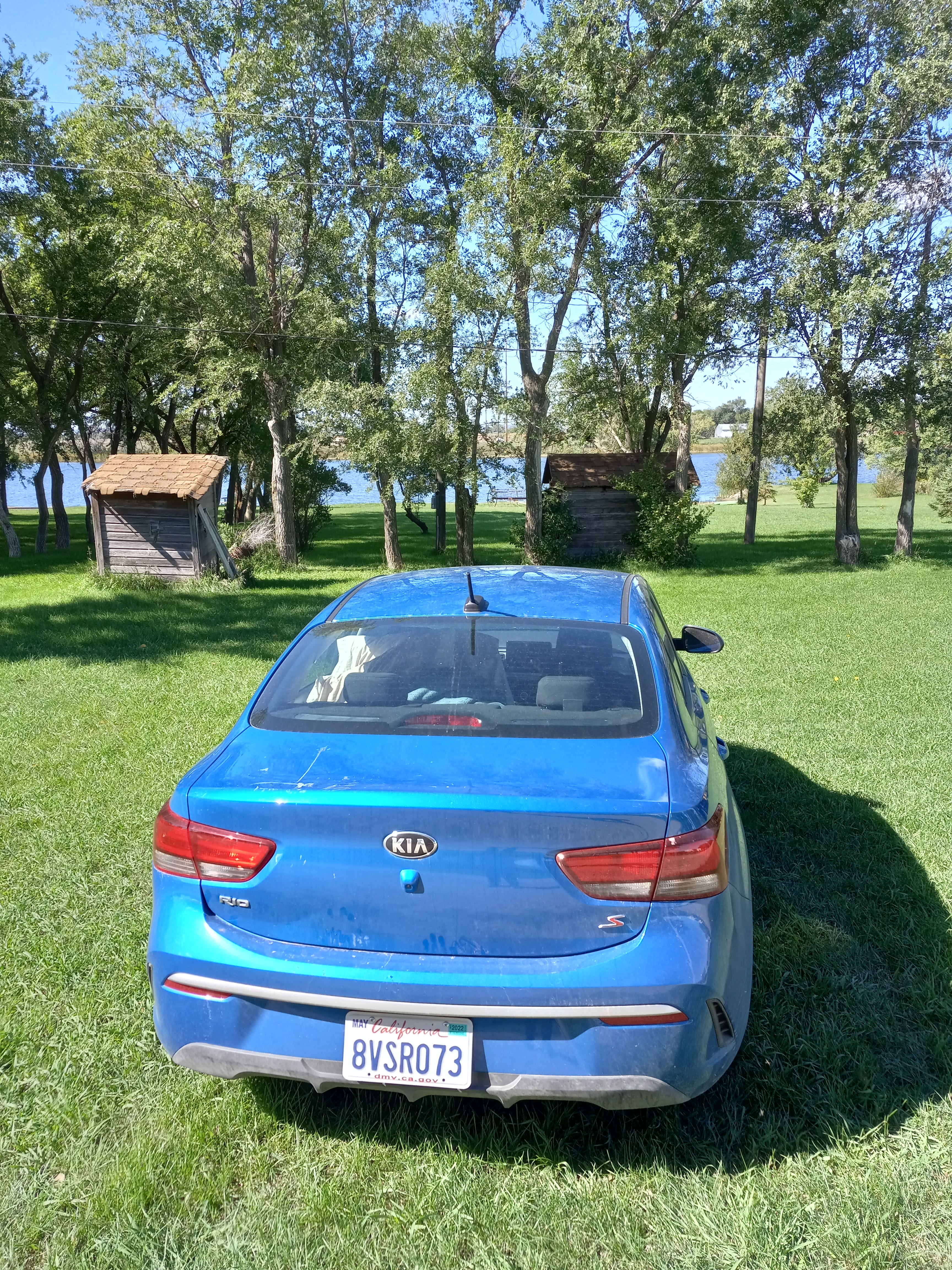
It was my plan to head over to Mount Rushmore that day, but first I planned on driving through Deadwood and Sturgis.  I was up before the break of day, as usual, wanting nothing more than to be driving my trusty rental car, the Mountain Bluebird, across not only the face of land, but that of time, seeking out and finding pages from the past that had been scattered along the way.

As I drove towards Deadwood the sun was only beginning to rise.  It sat atop a telephone pole like a pink golf ball on a tee.  Deadwood had come to life as a boomtown during the Gold Rush.  Overnight, the population went from practically zero to over 25,000 fortune-seekers.  Prospectors, gamblers, prostitutes.  It was a good place to get rich and also a good place to get killed.  The most famous assassination was that of Wild Bill Hickock, shot dead during a poker game holding what has become known as the Dead Man’s Hand, two black aces and two black eights.

Wild Bill Hickock is one of those figures out of the Wild West, who largely created his own legend.  He is reported to have been a soldier, scout, lawman, and gunslinger, but he was also a showman and actor, who appeared on stage with Buffalo Bill, so it is hard to separate the fact from the fiction.  His hair trigger temper may have stemmed from an earlier nickname he was given, Duck Bill, in which he was mocked for his long nose and protruding lips. 

Although reported to having killed over a hundred men in his life, the number may be closer to six or seven, under circumstances that may not have always been fair.  The man who shot him, Jack McCall, was eventually found guilty of his murder and hung.

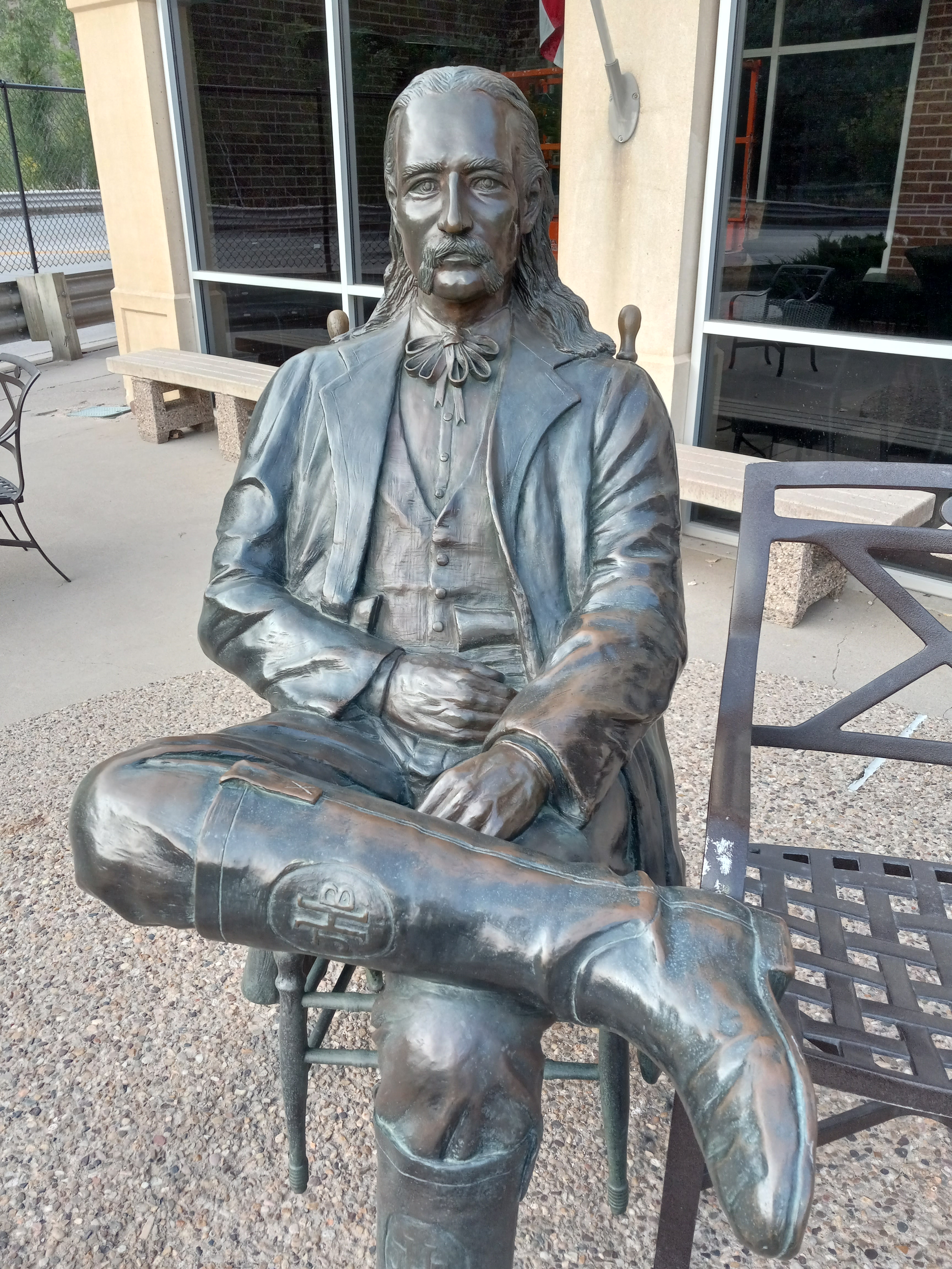
As I drove down Historic Main Street Deadwood it was still early.  I parked my car and the first thing I happened across was a statue of Wild Bill himself, sitting in a chair with his legs crossed, a plaque in front of him explain the origin of the Dead Man’s Hand. 

A mural not far from that showed an earlier version of the town with a bank, saloon, covered wagon, as well as Wild Bill, Calamity Jane, and a few other assorted frontier folks on horseback, facing the future.  There were shootouts on Mainstreet, every day except Sunday at two pm, ghost tours, old time photos, black hills gold and jewelry, casinos, the historic Bullock hotel, the Brothel, the Lucky Nugget Saloon.  None of these were open yet.  If anyone was out it was just a ghost, blowing down the street.

My next stop was in Sturgis, home to the largest motorcycle rally on the face of the planet, every summer for ten days at the end of August.  It was late September by now.  I’d missed it by a month.  Still, I went to have a look around.  Most of what I witnessed were just motorcycle shops and bars, not yet open yet either. 

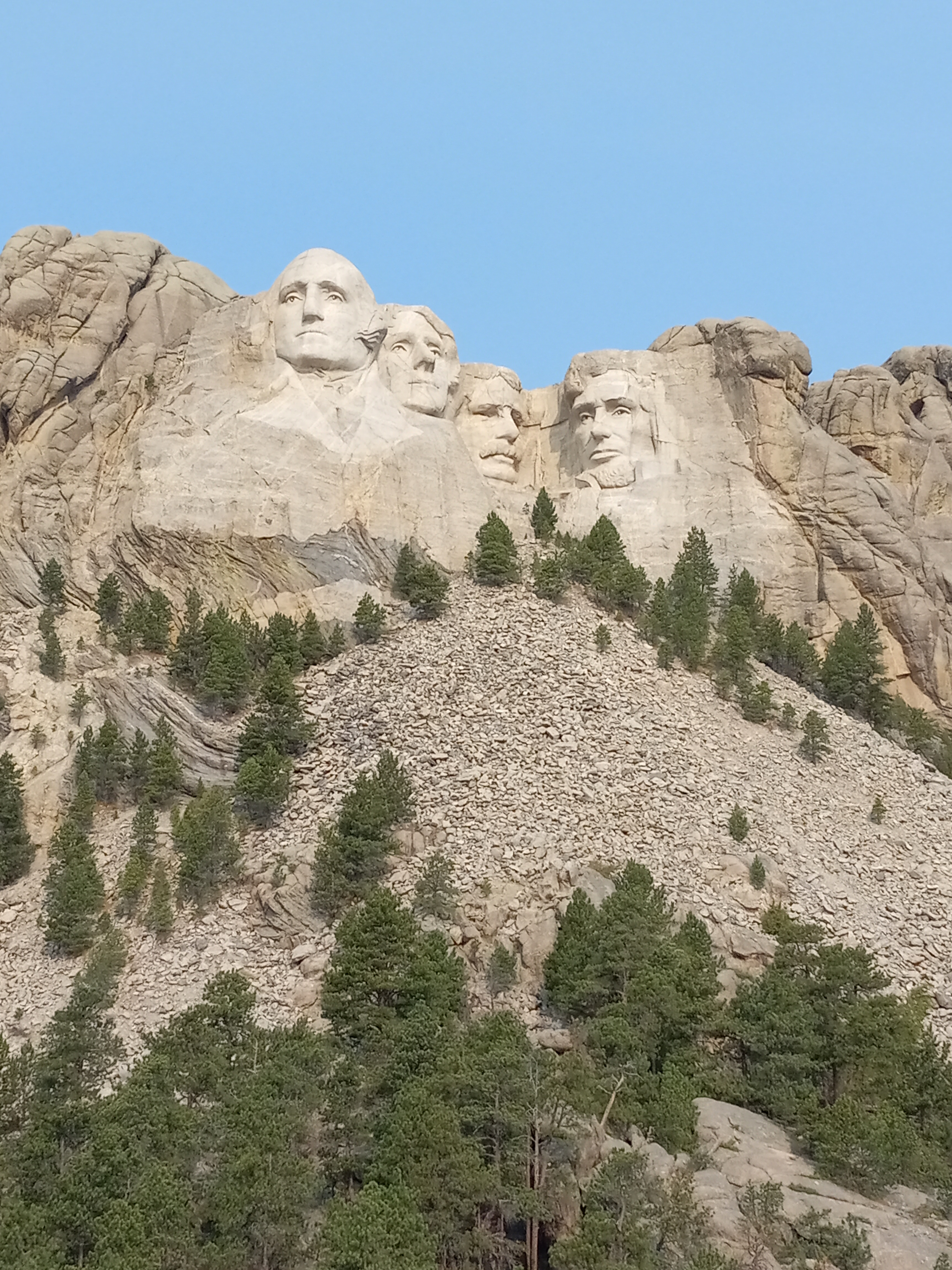
From there it was an hour and a half to Mount Rushmore.  I took the 90 to Rapid City and then the 16 south from there, passing Bear Country USA and Old McDonald’s Farm.  When I got to Cosmos Mystery Area, I turned left on the 16A.  In a few miles I could see them, the faces of the four presidents, looking smaller than expected.  I’d arrived at one of the greatest tourist attractions in the country, not for the first time, and hopefully not for the last.  It was time to get out and see, once again, what all of the fuss was about.

pages fly away 27

How many people know that Mount Rushmore is named after a New York Lawyer?   Or that the four faces carved into the mountain have a name – The Shrine of Democracy?   Or that the idea to create it came from a project that was already underway in the South called the Shrine of Confederacy, and that the same sculpture who was working on it, Gutzon Borglum, was commissioned for the job?   Or that the original idea for it was to carve out famous heroes of the West, including Lewis and Clark, Sacagewa, Buffalo Bill, Red Cloud, and Crazy Horse?  Or that once it was narrowed down to the four presidents the plan had been to show them to their waists?

Many people know that the Shrine of Democracy was caved on land that the sacred to the Sioux, but how many people know that the mountain had a name, the Six Grandfathers, four for the four directions on a compass, and two for the sky above and world below.  To put a sculpture of four presidents right there went down as well as if the Chinese were to carve the face of Chairman Mao onto the Statue of Liberty.  In 1980, it was formally recognized that the land was been taken illegally, and the Sioux were awarded 100 million, which they refused, wanting the land back, which had become known to them as the Shrine of Hypocrisy.

I don’t go there with any ideas about it or a political agenda.  Like most Americans, I’d seen images of it my whole life and was just enthralled to be there in person.  Perhaps, it was my fifth-or-sixth time visiting Mount Rushmore, the first time with my grandfather, in a helicopter that made him sick to his stomach. 

If you see it on television, one of those grand panoramic views of it taken from a helicopter, you envision Mount Rushmore as this sprawling, expansive thing that covers the side of a mountain, when in reality, upon first sight of it, the faces seem rather small, huddled together in one corner.  It is similar to arriving at the Pyramids in Egypt, only to discover that the famous Sphynx is not much larger than a trailer home.

The monument is free to get into.  There is a parking garage you need to pay to enter, but that is about it.  Outside of just looking at the faces from different angles, there is also a visitor center and gift shop and different trails that can be hiked.  The presidents from left to right are Washington, Jefferson, Teddy Roosevelt, and Lincoln, timeless in a way beyond Roosevelt’s eyeglasses and moustache.  As a young man I’d used a picture taken in front of Mount Rushmore, holding a beer with my eyes crossed out, as a flyer for my first concert.  Now, I just turned and took a few selfies, like everyone else was doing.

The next stop was the Crazy Horse Memorial, which involved driving west about thirty minutes on the 244.  Crazy Horse was a visionary leader of the Lakota Sioux.  He was named Curly as a child but had a vision where he saw a warrior on a horse come out of a lake.  The horse was able to float and dance in the air.  The warrior told him that if he remained modest and unadorned no one from his tribe could touch him.  If he took no scalps or war trophies, he would be invincible in war. 

Crazy Horse saw bullets and arrows flying around him, unable to hit him.  He witnessed a great thunderstorm.  His people could not hold him back.  Lightning struck his cheek and hailstones hit his body.  That became his warpaint.  He was a major player in both the Fetterman Massacre and the Battle of Little Big Horn.  Finally, forced into surrender, he was killed by a bayonet during a skirmish at Fort Robinson.

The idea for the Crazy Horse Memorial came from Henry Standing Bear, an elder of the Lakota tribe, and the job was given to Korczak Ziolkowlski, and was started in 1948.  Although the grand plan is to carve both Crazy Horse and his horse out of the mountain, to this date only the head and right arm have been completed.  The visitor center is still worth the price of admission, with artwork and artifacts from a number of tribes, and on this day Native Dancers on a small outdoor stage. 

After leaving the Crazy Horse Memorial, I drove back to Rapid City and headed towards Wall Drug on the 90 east.  I knew I was going in the right direction because of the ubiquitous billboards for Wall Drug that run for hundreds of miles along the road.  It started off as a roadside stop for travelers on their way to Mount Rushmore, offering free ice water, and went on to incorporate a pharmacy, art gallery, museum, and gift shop, in time becoming one of the greatest tourist traps in the land.  I was excited to get there.

I found a parking spot on Main Street and walked toward Café Entry No. 1, passing signs for five cent coffee refills, and windows that contained black and white photos, a cowboy drawing his gun, and boots for sale.  Inside was a menagerie of all things Old West, both real and make-believe, such as jackalopes, rabbits with small deer antlers grafted to their heads. 

There was Old Pappy the Cook.  Another shifty sidewinder with a slow-burning cigarette.  Calamity Jane, the rough, tobacco-chawing spitfire of the plain.  Wyatt Earp, lifting a pistol from his belt.  Next to him was the fortune-telling Cowpoke.  There were Annie Oakley and Buffalo Bill, mounted elk, caribou, and deer heads, a shaman lifting a buffalo skull, a saloon girl, and tough old granny, chomping a cigar and keeping her cards close to her chest. 

There was Wild Bill, the wagon train band, a snake oil salesman, a totem pole, George Custer, a giant Jackalope with a saddle, a buffalo, a grizzly bear.  Heck.  There was a frontiersman, a prospector and his mule, a recreation of one of the mines, complete with carts, stocked with minerals. 

A covered wagon and horses?  A bandit doing a shot?  Another showgirl in a bowler hat?  There was nothing they’d missed.  It was the wildest place to shop in the land.  The cash registers were ringing like Christmas bells.

pages fly away 28

Maco Sika, or the Badlands, were named so by the Lakota people because of their harsh, rocky environment, with high temperatures and a lack of water.  By the time I arrived at the north entrance it was ninety degrees, and I was feeling blown out and spent.  My National Park Pass came through in the clutch again, the Mountain Bluebird was calm and in control, and I’d regained my friend Karen from Google Maps, after passing through a dead zone of T-Mobile phone coverage in Wyoming. 

Still, I wasn’t sure what direction to take once I got in the park.  It all looked the same, miles of ringed buttes, bluffs, pinnacles, and hoodoos, the terrain of the underworld, forced up into the daylight.

It is small wonder that Table Mountain in the Badlands, was chosen as a site for a Ghost Dance in 1890.  The Ghost Dance came about through the Paiute holy man and prophet, Jack Wilson, or Wovoka, who saw in a vision that the white men would disappear, the tribes would be reunited with the spirits of their departed ones, and their hunting grounds would be restored to them by dancing the circle dance.  The Ghost Shirts that were created at the time, were thought to make those who wore them impervious to the bullets of their enemies.  It was following this particular dance that the Wounded Knee Massacre occurred, as the dancers were returning to the Pine Ridge Reservation.

It was a hot and dusty day, and I was irritable and didn’t know which way to drive.  I stopped at the Pinnacles Overlook and stared down at the jagged, banded landscape, then drove past Roberts Prairie Dog Town, seeing prairie dogs up scouting on their hindquarters, popping in and out of a small minefield of holes.  It didn’t seem like I was going the right direction.  I followed Sage Creek Road, and at one point seemed to have left the park.  When I reached the 41, I took a left, and soon came upon a checkpoint for the Pine Ridge Reservation. 

The Pine Ridge Indian Reservation is an Ogalala Sioux reservation that occupies three thousand square miles in the southeast of South Dakota.  It is famous for the Wounded Knee massacre, in which over two hundred and fifty Native men, women, and children, were killed, and fifty wounded, when the 7th Calvary under Colonel James Forsyth attempted to disarm them and a rifle went off.  The dead were then buried in a mass grave. 

Pine Ridge is also famous for the Wounded Knee Occupation of 1973, when two hundred Sioux, followers of the American Indian Movement, occupied the town of Wounded Knee in an effort to draw awareness to injustices that have been committed against their people.  The siege lasted for 71 days.  A US Marshall was shot and paralyzed and two of the protestors were killed by gunfire.  After ten weeks they surrendered their weapons, but a lot of awareness had been raised by then.  Much of the population became sympathetic to their cause, although little changed.

I drove until I reached the site of the Wounded Knee Massacre, where a large, red sign tells the tale of what went down.  Chief Big Foot, with 106 warriors and 250 women and children were camped and then surrounded by a force of 450 soldiers.  They had been dancing the Ghost Dance and were on their way to Pine Ridge. 

After surrendering, four Hotchkiss revolving guns were set up around the camp.  When a fight broke out, sparked by a single shot, the guns were used to mow down the crowd, which resulted in a stampede.  The shirts that they were wearing didn’t protect them and the Ghost Dancing largely ended with this mass slaughter.

To sit beside the sign, you would never know that something that awful had ever happened at the location.  The earth heals quickly, much quicker than the hearts and minds of people.  The grass was green.  A shelter, roofed by pine boughs, stood nearby.  I walked over and sat down on one of the benches beneath it.  It was late afternoon by now.  I had no idea where to stop for the night.  A Sioux in a cowboy hat pulled up in a pickup, but then quickly drove on.  I shut my eyes and could hear the wind blowing through the grass.  Dogs were barking in the distance. 

A fly began buzzing around my face.  Why does there always have to be a fly, buzzing around your face when you sit outside to meditate?  Some crickets were chirping and from somewhere I could hear the voices of children.  I thought about the bodies beneath the earth, and what, if anything was left of them. Four cars passed in a row.  A cool prairie breeze blew right in my face.  The voices of the children grew louder.  It sounded like they were coming through the trees.

pages fly away 29

There are nine Indian reservations in South Dakota.  My plan was to head up to North Dakota, driving though as many of them as I could, but it was late by the time I left Pine Ridge, and my attempts to find a campground, for the first time in almost two weeks, had come up short.  In the town of Martin, I gave up and checked into a hotel, getting a sub sandwich and bag of Doritos at a gas station across the street.  Having to pay a hundred dollars for the room made me anxious, not sure what I’d find for camping the further east I got.  If I had to start paying for hotels every night, the gig would soon be up.

In the morning I drove through the Rosebud Reservation, home of the Sicangu Lakota, known as the Burnt Thigh People, which may have come from an incident in the past where they were forced to flee a wildfire.  It was created in 1889 and the total land area is near 2,000 square miles.  I stopped outside the office of the law enforcement and later passed the Tribal Ranch.  On a grass hill were three crosses on a hill, above them a sign for the Rosebud Christian Center.  Continuing on, I passed a road marker dedicated to the Brule Chief, Spotted Tail.

At Mission, I took the 83 north to the 90 east, then got on the 47 north, crossing the Missouri River to drive though the Lower Brule and Crow Creek reservations.  A sign of an old woman holding the worlds in her hands implored Protect Unci Maka, or Grandmother Earth.  It was an hour to the capital of South Dakota, Pierre, from there.  The land was flat and the sky as blue as can be.  Clouds drifted slowly across the windshield like white buffalo.  Nothing else moved, just the car and the clouds.  All else was the same as it ever had been.

In Pierre I just drove past the capital building and continued on the 14 to the 63 north.  At Eagle Butte the headquarters of the Cheyenne River Sioux Tribe, there were a few murals, one of a hoop dancer, another of an old chief.  An eagle and feather were painted on the drive-through side of the Dairy Queen. 

The goal that day was to make it to Sitting Bull’s grave on the Standing Rock Reservation.  I was racing towards on the 63, going ninety miles an hour, just thinking to myself how I’d been flying over the land, when I was pulled over, for the first time on the trip, by a Tribal Police Officer.  He could’ve nailed me, but when he heard of my interest in Sitting Bull, let me go with just a warning.  I’d been lucky so far, almost every day, in almost every circumstance.  That doesn’t happen very often.  Maybe my karma was finally starting to level off.

The 63 turned into the 20 and I took that to the 12.  At the Grand River Resort and Casino, I took a right on the 1806.  It was a good thing Google Maps was working.  Karen told me where to go, like a spirit guide, and I just followed.  There are two burial sites for Sitting Bull, the one I was visiting now, at Mobridge, and one at Fort Yates.  The one I was visiting now was on extremely green grassland, overlooking the Missouri River.  There was a memorial to Sacagewa there as well, along with a map of the area. 

A grave marker describes how his death came about from his involvement in the Ghost Dance Movement.  It lists some of the notable events in his life and tells how his burial site was moved to the present location in 1953.  Beyond that, is a bust of his head and shoulders with his Lakota name, Tatanka Iyotake, Sitting Bull, and the years of his birth and death, 1831-1890.

If Sitting Bull is not the most famous Indian Chief in America, he is certainly in the top five.  This is due to his prominence as both a visionary and leader of the Hunkpapa Sioux and his involvement in the Battle of Little Big Horn.

When many of the tribes were turning to the reservations, Standing Bull and his followers, stubbornly stuck to their old ways, eventually seeking asylum in Canada for four years.  Decimated and starving, they were eventually forced into surrender and placed on Standing Rock Reservation.  In a paradoxical turn, he later went on to befriend Annie Oakley and became a featured attraction in Buffalo Bill’s Wild West Show, selling his photo and autograph for good money. 

In his last days, word spread that Sitting Bull was getting involved in the Ghost Dance, and tribal police were sent out to see he didn’t cause trouble.  A struggle broke out, and he was shot in the head and chest.

The sun was low on the horizon by now, a white circle, with white clouds fanning out from it, over miles of green, green prairie grass that were stirring in the wind.  I sat down on the hood of the Mountain Bluebird and faced the monument.  In that moment the wind picked up and began pushing at my back. 

Where do we come from and where do we go?  We know so much, but not the answer to that question.  We have ideas.  We make up stories.  We build churches and sit around campfires, looking up into the night sky, but we don’t know where we come from, and we don’t know where we go.  I knew I’d come from Pine Ridge that morning, that much I did know, but I had no idea where I’d even pull over and sleep that night.  What would happen the day I laid down and didn’t get up?  Where would I go then? 

A car was coming towards me.  The driver and passenger looked like they were up to something.  A thousand crickets began to chirp like a death rattle.  It felt like it was time to move on.

pages fly away 30

The Standing Rock Indian Reservation is the sixth largest reservation in the United States and straddles North and South Dakota.  It is 3,500 square miles and supports a population of roughly 8,000 people.  The Sioux had been a nomadic tribe of hunters and gatherers and once they were put onto reservations, expected to give up their traditional ways and adopt European lifestyles and mannerisms that held no appeal.  The Great Sioux Reservation, that at one time spanned across most of South Dakota kept getting broken down into smaller reservations, to keep the occupants isolated. 

In 2016, the Standing Rock Reservation got a lot of media attention when three to four thousand activists, which included members of three hundred recognized tribes, descended on the Sacred Stone Camp to protest the Dakota Access Pipeline, which was threatening the primary water source for the reservation.  Protesters chained themselves to machinery to stop the work from taking place and police responded with pepper spray and attack dogs. 

Later in the year, 2,000 US Military Veterans arrived to help shield the protesters from the police.  The protest had earned a lot of support.  Eventually, some concessions were made but the pipeline was completed regardless.

After leaving Sitting Bulls grave, I drove into Fort Yates and visited his original burial site.  There were a few plaques telling his life story, including one that had a picture of him with his family.  Another showed him standing with Buffalo Bill.  I drove past murals of a chief in a headdress and a white buffalo, and then reached the Standing Rock monument, beside the Missouri River.  It is a rock that is purported to once have been a woman or child who was turned to stone, and is regarded as sacred, with great healing properties.

The sun had already set by now and I had no idea where I’d sleep that night.  The plan was to travel to Bismark, so I just drove in that direction, north on the 1806.  I thought I might search for a campsite when I got to the capital, but instead just happened to pass one along the way, the Sugarloaf Bottoms, just outside of Fort Rice. 

A full yellow moon had just risen, and it felt like a magical night.  There were only two RVs at the site.  By now it was fully dark, but then the moon, white and phosphorescent, rose up over the trees like a lantern.  I hurried to throw my tent up, and then went off to look for a fee box.  It was ten dollars, no reservation required.

It was freezing cold that night.  Wolves howled in the distance.  A flock of geese flew overhead.  Somewhere an owl started to hoot.  I lay on my side, exhausted, but still scheming.  Before the sun rose, I leapt up and got on the road, driving all the way to Bismark in the dark.  There, I visited the United Tribes Technical College, which had hosted a powwow a few weeks earlier.  If things had worked out differently, that may have been my first destination.  The sun still hadn’t risen.  I drove in and drove out.

It was only when I got back on the highway, heading west on the 94 towards Jamestown that the sun made its first appearance of the day.  It looked like it was rising up out of the yellow stripes on the road ahead of me.  I would make a stop in Jamestown but had bigger fish to fry that day. 

My father had been a preacher and I’d grown up as a nomad.  Our greatest period of stability had been four years in a small farm town in North Dakota, Ellendale.  Four years isn’t long, but I’d attended school there from the middle of seventh grade to the middle of eleventh grade, in this town of only two thousand people.  Those are influential years and the people and places from that time had become part of my personal mythology. 

The only reason I pulled over in Jamestown was to visit the biggest buffalo in the world.  It is twenty-six feet tall, weighs eighty tons, and stands at the end of Louis L’ Amour Lane, named after the great western novelist from North Dakota.  Whenever we drove past the buffalo as kids, someone would have to shout and point it out.

The buffalo was there, looking rather shapeless, but imposing, nonetheless.  All around it and leading up to it was Frontier Village, a model Old West Town, with wagons, a saloon, a sheriff’s office, dentist office, trading post, and the Pioneer Church.  They also had the Louis L’ Amour Writing Shack, but it was closed.  I walked up and down the little Main Street, amped up and almost shaking in my shoes. 

Then it was time to go visit another little prairie town, one that had only existed in foggy memories and dreams for the past forty years, full of pieces of the past, maybe nothing more than that.  It was time to find out.

pages fly away 31

Ellendale, North Dakota, is a small farming town on the border of South Dakota.  It was where my family moved to after my father had lost his job at a Bible Camp in Iowa.  Prior to that, my parents had been Jesus Freaks in Hawaii.  I grew up mostly putting my things into boxes and moving on.  As the oldest kid, that pattern of migration would go on to dictate my life, long after everyone else had stopped playing by those rules.  We moved to Southern California in 1984, and the rest of the family settled.  All these many years later, I was still bouncing.

From Jamestown, I took the 281 to get to Ellendale.  About a half hour out I began recognizing some of the other small farm towns in the vicinity; Edgely, Monango, Fullerton.  The closer I got, the more my chest began to swell with anticipation.  Then I could hardly believe it, but I was driving into town. 

There was the Oxenrider Hotel, right across from the Nursing Home where I’d worked for a year taking out food carts and scrubbing dishes.  There across highway 11 was Jay’s Highway Furniture, and opposite it the church, Christ the King Lutheran, where my father had been pastor for four years.  I drove into the parking lot and felt like I was hallucinating, seeing the actual church that had appeared in so many dreams since the time we moved.  Then I made my way over to the parsonage.  Someone had added a deck, but it was the same house where we’d lived, the six of us.  Out back we’d once had a colossal garden that had returned to being tall grass.

The houses of the old next-door neighbors were still there.  Who knew who was living in them now?  Everything I’d learned about sex education had come from the older neighbor girl across the street, Lynn Nichols. Across from her house was the one the Schwartzman’s used to live in, with the twins and the girl in my grade.  If I caught up with them now, we’d all be middle-aged.  That was a trip.

I drove over to the drive-in restaurant where my father had once pestered the manager, a member of his church, into giving me a job.  That hadn’t lasted long.  I’d brutalized soft-serve ice cream cones and burned hamburgers.  My father had also gotten me the job at the nursing home.  Left to my own devices, all I could ever think to do for money was rustle up empty bottles.  We always had a roof over our heads and food to eat, but there was never any extra money lying around.

From the block we used to live on, I drove up to the Fireside Steakhouse and Lounge, once known as The Ranch, one of the only places in town to get a fancy meal.  My friend, Rick Hazard, used to live close to The Ranch, beneath the emergency siren, but his house was gone.  I found the County Courthouse, and that looked the same, but the school we’d all gone to, the one that housed the elementary, junior high, and high school, all in the same complex, had been restructured and was all just one story now.  The entrance had been moved to the other side, but I did see that the school was still using the Fighting Cardinals as their mascot. 

It is such a small town, the Main Street, just three or four blocks along, that it didn’t take long to drive through.  The corner bar that I remembered was still there, but many of the retail spaces were vacant, these days people preferring to drive to the Walmart in Aberdeen or order off of Amazon, I imagine.  I drove down to the park and swimming pool, then past the mansion that Martha Best, the girl who ditched me in ninth grade for my best friend, Ritchie Wallace, used to live in. 

Trinity Bible School is still in operation.  Our high school used to use their gymnasium for our biggest sporting events.  From there I passed the Dickey County Fairgrounds, site of the annual summer Rodeo Days, and the baseball field where I’d played, quite poorly, in the Babe Ruth League.

Seven miles outside of town is a dammed-up river called Pheasant Lake, really almost as much of a cow pasture as it is a lake.  We’d once owned a small lot out there, with a tar and paper shack and a dock.  I headed west on the 11, past the bowling alley and familiar old grain elevator, and found the lake.  The nice houses are on the west side of it.  Our shack had been up a dirt road on the east side. 

I drove down a mile or so and found the lot, the only thing left on it being an outhouse that we’d dragged over from an old homestead.  That and a small shed that had been constructed since that time.  I pulled into the lot and walked down to the lake. The water was really low.  The docks on the neighboring properties jutted out into a few inches of mud.  It seemed like you could walk across to the farm on the other side. 

There was a rock pile underneath some powerlines where I used to chew tobacco and fish for northerns.  Now it was twenty feet from the shore.  I walked back up through the green grass and sat with my back to the outhouse.  The town was still there.  The lake, though fairly famished, was still there.  Some of the houses and building were still there.  The people I’d known, however, had mostly grown up, grown old, died, or moved away.  There was no one left for me to call or look up.

Why is it that we feel things so strongly and then at some point just vanish from the face of the earth?  A chilly breeze came through, rustling the leaves in the trees.  There were the flies, always the flies, and the crickets, sometimes the crickets.  Who was the one holding onto all these memories?  What was I looking for?  A herd of cows was bellowing from across the lake.  The wind picked up.  It was almost blowing through me. 

Overhead there was the sound of an airplane, faint at first, growing louder, reaching a crescendo, the starting to fade away, almost like a life span.  I remembered the time my mother’s parents had stayed at the lake in their camper and my grandpa had shot a raccoon.  We’d considered him a modern-day Davy Crockett after that.  Martha Best had lived in a beautiful cabin across the lake.  Once I’d driven over in our little fishing boat, ashamed to show up in our family station wagon with all the religious propaganda pasted to it. 

What had happened to all the kids?  Where had Davy Crockett gone?  Was Marth Best still alive?  If so, I wondered if she ever thought of me.  Geese flew overhead.  Wind tore at the trees.  Pages were flying away all around me.  There was no way to catch them.  The only thing I could do was let them go.

pages fly away 32

Nothing bad had happened in Ellendale, but on my way out of town I felt lonely and depressed.  I had been back a few times since my family moved to California, but the last time I’d seen the old crowd, I’d changed and nobody else had.  Now I was adrift on my own, either unable or unwilling to commit myself to relationships or a community.  When you romanticize them, you don’t remember what a drudgery they both can be, but they can.  They can even turn deadly.

I thought I knew how to find Ritchie’s Wallace’s farm, where I’d worked as a hired man for a few summers, mostly just hanging out with Ritchie, driving the farm truck around, helping out with chores.  Either it had changed hands, however, or I was just lost.  I wasn’t able to find any of the landmarks I was looking for.  I made my way back to the highway and crossed into South Dakota, pulling over at Frederick, where we used to look for seniors to pimp us beer, since the drinking age across the state line had been eighteen at the time.  It was just about thirty more miles to Aberdeen.

When we lived in Ellendale, Aberdeen had been the closest big town.  We used to drive down there if we wanted to get fast food or shop at a mall.  It was more than just that though.  My mother had a step-grandfather in a nursing home there.  The first time we went to visit him he was throwing water at the nurses.  The second time we brought him a box of chocolates and he yanked a rubber knob off his bed post and ate that instead.  She also had a step-uncle who lived in Aberdeen with his wife and well-endowed, blonde daughter.

Nowadays, I’d been around the world, and Aberdeen seemed more like a big town than anything.  I looked for the Pizza Hut where my friends and I used to try to get served pitchers of beer at.  Then I tracked down the Holiday Inn where my family had gone for brunch after my confirmation and my friends had held a going away party for me before we moved to California.  My mission was to track down the little farm town, Pierpont, where my mother’s side of the family was from.

Both sides of our family come from Scandinavian immigrants who came over to homestead South Dakota at the end of the 19th century.  My mother’s family had a farm around Pierpont.  My father’s family was from Viborg.

It was just forty miles from Aberdeen to Pierpont, but I never would’ve found it without Google Maps, as it wasn’t even on the map.  Karen, the voice of Google Maps, by now my savior a dozen times over, directed me there.  I’d only been there a few times in my life.  My grandpa’s sister had been married to a farmer who’d shown us a good time when we stopped by, letting us ride the riding lawnmower and shoot a pistol.  Along with some second cousins, my brother and I had put ourselves in some danger, walking a beam along the pig pen and pissing on an electric fence.  Now I was there, in the middle of nowhere, with nothing but Google Maps and a small sign to tell me I’d arrived.

My Grandpa had gotten sick of life on the farm and gone off to business school with a cardboard suitcase.  It was hard to say who was left in the town.  The population is just over a hundred people, perhaps most of them on the outlying farms.  I found a small service station, restaurant, and baseball park, but that was about it, beyond a few blocks of houses.  The family farm was long gone by now.  There was no trace of any living relatives.

From Pierpont, I drove to the Lake Traverse Indian Reservation, home to the Sisseton Wahpeton Oyate.  It was created in 1867 and has some ten thousand inhabitants.  There I drove past the Sisseton Wahpeton College.  One of the buildings features four drummers in a circle, holding drumsticks in the air.  I then followed a sign pointing to the powwow grounds and came to the Winfield Thompson Sr. Memorial Dance Arena.

By now I was just frazzled.  My circuits were starting to short out due to over-stimulation and fatigue.  I had some idea about driving into Minnesota and finding a campground.  It shouldn’t have been that difficult to do.  Instead, I got on Google Maps and went from the 127 to the 9 to the 108 to the 59, through Pelican Rapids and Detroit Lakes, past all these beautiful lakes that seemed perfect to stop at, but only had resorts, rather than campgrounds.  I followed one lead for a long way, only to find myself in a field where they occasionally staged big concerts, with no one else out there and no facilities.

The leaves were changing all around me, orange, yellow, red, green.  It was spectacular for a leisurely drive, but I was about to have a seizure and run my car into a ditch.  I got on the 34 and headed west, ready to just pull over and sleep by the side of the road.  Karen, from Google Maps, had a last place to check out for me, the Hungry Man Forest Campground.  I took the 37 east, past Shell Lake, then the 58 to the 44.  Night had fallen.  Oh my, God.  There was a sign. 

I pulled off and followed in in the wrong direction, down a private driveway.  I turned around and took it the other way, pulling into a spot, just when the night couldn’t have gotten any blacker.  What a profound relief.  I kept the headlights on and threw up the tent, then crawled inside and just lay there panting.

It was so dark when I pulled in, that I’d had no idea where I even was.  As soon as the sun came up, I found I was only about a hundred yards from a lake.  I went down and found a dock that I walked to the end to.  Mist was rising from the water. 

The lakes of northern Minnesota are frozen and buried beneath the snow for half of the year.  When they break free, they are rare jewels, a testimony to those who suffer, that beauty is right around the corner.  When it is time to go out again, they do it in grand fashion, waving flags of every color, knowing that it is not really the end, but just goodbye for now.  They were getting ready to say goodbye for now.  I was lucky to be crashing the party.